Map of Brixton station, London
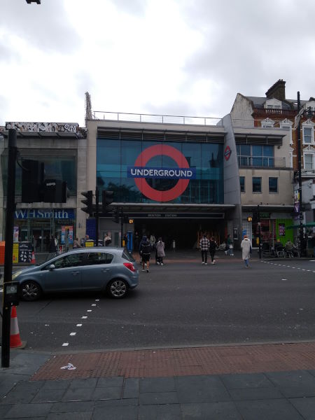
Brixton station
| Postcode | SW9 8HE |
|---|
Transport
| Travel zone | 2 |
|---|---|
| Tube/Rail lines | |
| Next stations | |
| Nearby stations | |
| Bus stops |
Brixton Station (SE)
Gresham Rd Brixton Police Stn (W)
Brixton Academy (W)
Electric Lane (W)
Brixton Station (N)
Electric Lane (E)
|
| Station code (TLC) | BRX |
| Station code (NLC) | 5081 |
| Owner | Southeastern |
| National Rail Enquiries | |
Live Departures
Live Arrivals
Usage
Entries and exits
Interchanges
| Year | Entries and exits | Annual change % | Interchanges | Annual change % |
|---|---|---|---|---|
| 2023 | 704,160 | 9.1 % | ||
| 2022 | 645,718 | 116.1 % | ||
| 2021 | 298,874 | -73.6 % | ||
| 2020 | 1,131,682 | -7.8 % | ||
| 2019 | 1,227,746 | -8.2 % | ||
| 2018 | 1,338,068 | -0.5 % | ||
| 2017 | 1,344,198 | 4.8 % | ||
| 2016 | 1,282,232 | 21.5 % | ||
| 2015 | 1,055,340 | 12.0 % | ||
| 2014 | 942,548 | 5.1 % | ||
| 2013 | 896,848 | 6.3 % | ||
| 2012 | 843,776 | 7.4 % | ||
| 2011 | 785,610 | 14.3 % | ||
| 2010 | 687,127 | 4.7 % | ||
| 2009 | 656,286 | 2.3 % | ||
| 2008 | 641,523 | -1.7 % | ||
| 2007 | 652,422 | 58.1 % | ||
| 2006 | 412,621 | 8.2 % | ||
| 2005 | 381,182 |
Note: Data is for financial years, so 2020 is April 2019 to March 2020
Geography
| Latitude | 51.463297 | |
|---|---|---|
| Longitude | -0.114183 | |
| Easting | 531076 | |
| Northing | 175437 | |
| Grid reference | TQ310754 | |
| UTM reference | 30U 700454 5705297 | |
| what3words | ||
| Plus code | ||
| Distance away |
Postcodes
This map shows the postcodes where this station is the nearest to the postcode (as the crow flies)