Map of Camden Road station, London
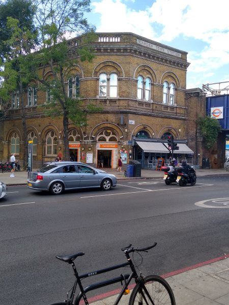
Camden Road station
| Postcode | NW1 9LQ |
|---|
Transport
| Travel zone | 2 |
|---|---|
| Tube/Rail lines | |
| Next stations | |
| Nearby stations | |
| Bus stops |
Camden Road Station (N)
Royal College Street Ivor Street (N)
Camden Road Station (S)
St Pancras Way (NE)
Camden Town Camden Road (NE)
Camden Gardens (S)
|
| Station code (TLC) | CMD |
| Station code (NLC) | 1440 |
| Owner | London Overground |
| National Rail Enquiries | |
Live Departures
Live Arrivals
Usage
Entries and exits
Interchanges
| Year | Entries and exits | Annual change % | Interchanges | Annual change % |
|---|---|---|---|---|
| 2023 | 3,724,674 | 21.3 % | 11,725 | 29.2 % |
| 2022 | 3,071,342 | 107.2 % | 9,077 | 51.7 % |
| 2021 | 1,482,204 | -67.5 % | 5,983 | -57.2 % |
| 2020 | 4,560,560 | -8.2 % | 13,965 | 15.3 % |
| 2019 | 4,968,410 | -1.0 % | 12,116 | -76.9 % |
| 2018 | 5,016,280 | -4.6 % | 52,351 | 0.4 % |
| 2017 | 5,257,708 | 2.7 % | 52,156 | 460.8 % |
| 2016 | 5,120,672 | 3.4 % | 9,301 | -37.4 % |
| 2015 | 4,952,576 | 4.6 % | 14,861 | 10.5 % |
| 2014 | 4,736,392 | 24.3 % | 13,443 | 351.6 % |
| 2013 | 3,810,066 | 23.5 % | 2,977 | -87.6 % |
| 2012 | 3,085,394 | 68.3 % | 24,093 | 296.7 % |
| 2011 | 1,833,296 | 53.6 % | 6,074 | -13.6 % |
| 2010 | 1,193,916 | -15.6 % | 7,027 | -48.0 % |
| 2009 | 1,414,848 | -26.9 % | 13,506 | 8.4 % |
| 2008 | 1,935,301 | -3.5 % | 12,459 | 203.4 % |
| 2007 | 2,005,886 | 191.3 % | 4,106 | 98.8 % |
| 2006 | 688,609 | 19.2 % | 2,065 | 105.3 % |
| 2005 | 577,851 | 1,006 |
Note: Data is for financial years, so 2020 is April 2019 to March 2020
Geography
| Latitude | 51.541789 | |
|---|---|---|
| Longitude | -0.138701 | |
| Easting | 529140 | |
| Northing | 184191 | |
| Grid reference | TQ291841 | |
| UTM reference | 30U 698410 5713957 | |
| what3words | ||
| Plus code | ||
| Distance away |
Postcodes
This map shows the postcodes where this station is the nearest to the postcode (as the crow flies)