Map of Cheam station, London
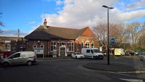
Cheam station
| Postcode | SM3 8RZ |
|---|
Transport
| Travel zone | 5 |
|---|---|
| Tube/Rail lines | |
| Next stations | |
| Nearby stations | |
| Bus stops |
Cheam Station (N)
Cheam Broadway (W)
Cheam Broadway (S)
Cheam Broadway (N)
Cheam Broadway (E)
St Dunstan's Hill (W)
|
| Station code (TLC) | CHE |
| Station code (NLC) | 5352 |
| Owner | Govia Thameslink Railway (Southern) |
| National Rail Enquiries | |
Live Departures
Live Arrivals
Usage
Entries and exits
Interchanges
| Year | Entries and exits | Annual change % | Interchanges | Annual change % |
|---|---|---|---|---|
| 2023 | 790,362 | 18.8 % | ||
| 2022 | 665,166 | 150.1 % | ||
| 2021 | 265,946 | -76.1 % | ||
| 2020 | 1,114,808 | 2.6 % | ||
| 2019 | 1,086,296 | 9.8 % | ||
| 2018 | 989,268 | 1.1 % | ||
| 2017 | 978,986 | -13.1 % | ||
| 2016 | 1,126,420 | -3.6 % | ||
| 2015 | 1,168,046 | 5.1 % | ||
| 2014 | 1,110,888 | 3.7 % | ||
| 2013 | 1,071,236 | -0.2 % | ||
| 2012 | 1,073,562 | 2.1 % | ||
| 2011 | 1,051,736 | -0.1 % | ||
| 2010 | 1,052,920 | -2.5 % | ||
| 2009 | 1,080,256 | -2.6 % | ||
| 2008 | 1,109,639 | 11.0 % | ||
| 2007 | 999,671 | 41.8 % | ||
| 2006 | 705,233 | 6.7 % | ||
| 2005 | 661,160 |
Note: Data is for financial years, so 2020 is April 2019 to March 2020
Geography
| Latitude | 51.355478 | |
|---|---|---|
| Longitude | -0.214168 | |
| Easting | 524444 | |
| Northing | 163334 | |
| Grid reference | TQ244633 | |
| UTM reference | 30U 693966 5693040 | |
| what3words | ||
| Plus code | ||
| Distance away |
Postcodes
This map shows the postcodes where this station is the nearest to the postcode (as the crow flies)