Map of St Helier station, London
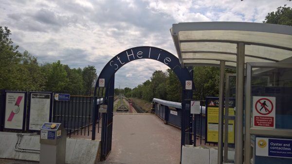
St Helier station
| Postcode | SM4 6SF |
|---|
Transport
| Travel zone | 4 |
|---|---|
| Tube/Rail lines | |
| Next stations | |
| Nearby stations | |
| Bus stops |
St Helier (SE)
Central Road (E)
Central Road (W)
Love Lane St Helier (E)
Love Lane St Helier (W)
London Road The George (S)
|
| Station code (TLC) | SIH |
| Station code (NLC) | 5290 |
| Owner | Govia Thameslink Railway (Thameslink) |
| National Rail Enquiries | |
Live Departures
Live Arrivals
Usage
Entries and exits
Interchanges
| Year | Entries and exits | Annual change % | Interchanges | Annual change % |
|---|---|---|---|---|
| 2023 | 140,056 | 8.6 % | ||
| 2022 | 129,012 | 82.9 % | ||
| 2021 | 70,548 | -62.8 % | ||
| 2020 | 189,644 | 11.9 % | ||
| 2019 | 169,546 | -8.2 % | ||
| 2018 | 184,618 | 0.7 % | ||
| 2017 | 183,280 | -19.3 % | ||
| 2016 | 227,096 | -3.0 % | ||
| 2015 | 234,078 | 4.1 % | ||
| 2014 | 224,882 | 17.0 % | ||
| 2013 | 192,132 | 7.8 % | ||
| 2012 | 178,222 | 18.4 % | ||
| 2011 | 150,520 | 25.1 % | ||
| 2010 | 120,348 | -14.3 % | ||
| 2009 | 140,430 | -17.9 % | ||
| 2008 | 171,141 | 54.1 % | ||
| 2007 | 111,026 | 109.1 % | ||
| 2006 | 53,088 | 9.1 % | ||
| 2005 | 48,645 |
Note: Data is for financial years, so 2020 is April 2019 to March 2020
Geography
| Latitude | 51.389899 | |
|---|---|---|
| Longitude | -0.198771 | |
| Easting | 525408 | |
| Northing | 167191 | |
| Grid reference | TQ254671 | |
| UTM reference | 30U 694892 5696908 | |
| what3words | ||
| Plus code | ||
| Distance away |
Postcodes
This map shows the postcodes where this station is the nearest to the postcode (as the crow flies)