Map of Ash station
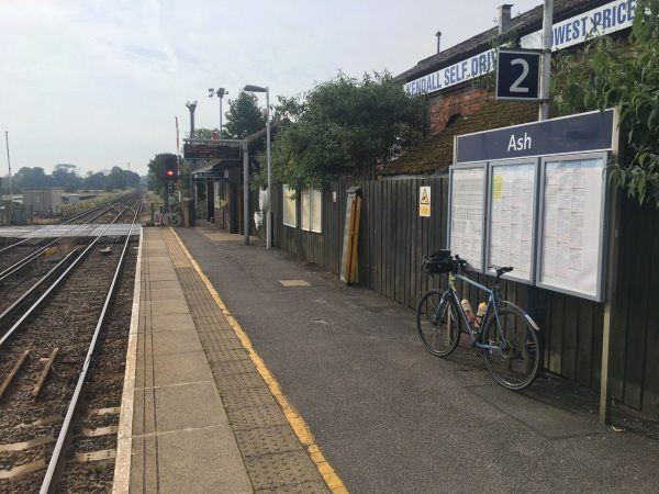
Photo: Martin W
Ash station
| Postcode | GU12 6JW |
|---|
Transport
| Nearby stations | |
|---|---|
| Bus stops |
Ash Railway Station (SW)
Chester Road (S)
Chester Road (NE)
Ash Hill Road (W)
Ash Hill Road (E)
St Peters Church (W)
|
| Station code (TLC) | ASH |
| Station code (NLC) | 5641 |
| Owner | South Western Railway |
| National Rail Enquiries | |
Live Departures
Live Arrivals
Usage
Entries and exits
Interchanges
| Year | Entries and exits | Annual change % | Interchanges | Annual change % |
|---|---|---|---|---|
| 2023 | 204,050 | 27.5 % | 32,638 | 69.4 % |
| 2022 | 160,032 | 138.3 % | 19,266 | 167.2 % |
| 2021 | 67,150 | -72.7 % | 7,209 | -66.7 % |
| 2020 | 245,978 | -8.3 % | 21,645 | -27.8 % |
| 2019 | 268,106 | 2.6 % | 29,975 | -18.0 % |
| 2018 | 261,276 | -6.4 % | 36,561 | 7.9 % |
| 2017 | 279,244 | -3.2 % | 33,873 | -1.9 % |
| 2016 | 288,430 | -0.0 % | 34,523 | 8.3 % |
| 2015 | 288,550 | 5.0 % | 31,889 | -3.3 % |
| 2014 | 274,754 | -3.1 % | 32,994 | -1.2 % |
| 2013 | 283,620 | 3.8 % | 33,379 | -10.5 % |
| 2012 | 273,232 | 0.8 % | 37,297 | -15.3 % |
| 2011 | 270,936 | -6.2 % | 44,054 | 15.6 % |
| 2010 | 288,932 | 2.6 % | 38,106 | 12.7 % |
| 2009 | 281,700 | 3.4 % | 33,826 | 12.9 % |
| 2008 | 272,414 | 14.0 % | 29,957 | 17.8 % |
| 2007 | 238,863 | 6.4 % | 25,435 | 15.4 % |
| 2006 | 224,467 | 4.1 % | 22,042 | 15.2 % |
| 2005 | 215,700 | 19,141 |
Note: Data is for financial years, so 2020 is April 2019 to March 2020
Geography
| Latitude | 51.249597 | |
|---|---|---|
| Longitude | -0.712805 | |
| Easting | 489934 | |
| Northing | 150834 | |
| Grid reference | SU899508 | |
| UTM reference | 30U 659619 5680066 | |
| what3words | ||
| Plus code | ||
| Distance away |
Postcodes
This map shows the postcodes where this station is the nearest to the postcode (as the crow flies)