Map of Goring and Streatley station
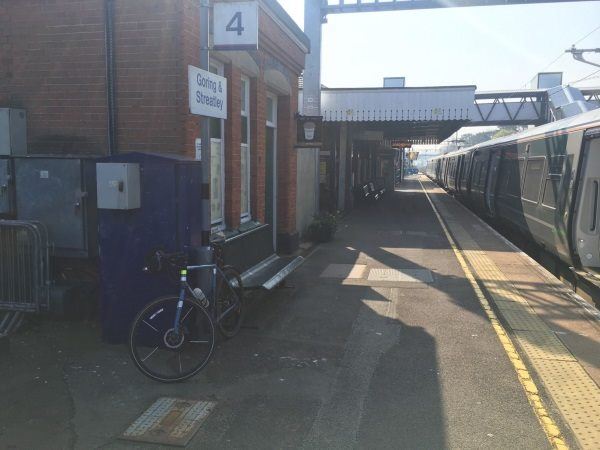
Photo: Martin W
Goring and Streatley station
| Postcode | RG8 0EP |
|---|
Transport
| Nearby stations | |
|---|---|
| Bus stops |
Lockstile Way (W)
Lockstile Way (E)
Cleeve Road (SW)
Cleeve Road (NE)
Station Road ()
Lockstile Mead (N)
|
| Station code (TLC) | GOR |
| Station code (NLC) | 3033 |
| Owner | Great Western Railway |
| National Rail Enquiries | |
Live Departures
Live Arrivals
Usage
Entries and exits
Interchanges
| Year | Entries and exits | Annual change % | Interchanges | Annual change % |
|---|---|---|---|---|
| 2023 | 288,174 | 25.6 % | ||
| 2022 | 229,414 | 178.5 % | ||
| 2021 | 82,368 | -81.2 % | ||
| 2020 | 437,286 | 1.0 % | ||
| 2019 | 432,860 | 7.2 % | ||
| 2018 | 403,646 | -4.4 % | ||
| 2017 | 422,086 | 2.9 % | ||
| 2016 | 410,134 | 2.2 % | ||
| 2015 | 401,356 | 0.6 % | ||
| 2014 | 398,894 | 2.8 % | ||
| 2013 | 387,896 | 2.6 % | ||
| 2012 | 378,192 | 2.9 % | ||
| 2011 | 367,660 | -1.8 % | ||
| 2010 | 374,298 | 0.2 % | ||
| 2009 | 373,686 | 1.9 % | ||
| 2008 | 366,714 | 5.4 % | ||
| 2007 | 348,051 | 1.2 % | ||
| 2006 | 343,840 | -4.0 % | ||
| 2005 | 358,203 |
Note: Data is for financial years, so 2020 is April 2019 to March 2020
Geography
| Latitude | 51.521493 | |
|---|---|---|
| Longitude | -1.133049 | |
| Easting | 460247 | |
| Northing | 180642 | |
| Grid reference | SU602806 | |
| UTM reference | 30U 629524 5709471 | |
| what3words | ||
| Plus code | ||
| Distance away |
Postcodes
This map shows the postcodes where this station is the nearest to the postcode (as the crow flies)