Map of Box Hill and Westhumble station
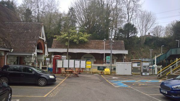
Box Hill and Westhumble station
| Postcode | RH5 6BT |
|---|
Transport
| Nearby stations | |
|---|---|
| Bus stops |
Westhumble Street (S)
North Downs Way (S)
Zig Zag Road (N)
Zig Zag Road (S)
|
| Station code (TLC) | BXW |
| Station code (NLC) | 5403 |
| Owner | Govia Thameslink Railway (Southern) |
| National Rail Enquiries | |
Live Departures
Live Arrivals
Usage
Entries and exits
Interchanges
| Year | Entries and exits | Annual change % | Interchanges | Annual change % |
|---|---|---|---|---|
| 2023 | 105,948 | 13.3 % | ||
| 2022 | 93,512 | 90.9 % | ||
| 2021 | 48,982 | -57.5 % | ||
| 2020 | 115,152 | 12.4 % | ||
| 2019 | 102,486 | 4.4 % | ||
| 2018 | 98,210 | 0.4 % | ||
| 2017 | 97,854 | -3.9 % | ||
| 2016 | 101,864 | -1.0 % | ||
| 2015 | 102,914 | 22.6 % | ||
| 2014 | 83,914 | -19.3 % | ||
| 2013 | 103,962 | 28.2 % | ||
| 2012 | 81,122 | 29.2 % | ||
| 2011 | 62,772 | 7.1 % | ||
| 2010 | 58,588 | 9.1 % | ||
| 2009 | 53,682 | 4.5 % | ||
| 2008 | 51,376 | 15.3 % | ||
| 2007 | 44,548 | 5.6 % | ||
| 2006 | 42,204 | -2.4 % | ||
| 2005 | 43,255 |
Note: Data is for financial years, so 2020 is April 2019 to March 2020
Geography
| Latitude | 51.254011 | |
|---|---|---|
| Longitude | -0.32849 | |
| Easting | 516744 | |
| Northing | 151865 | |
| Grid reference | TQ167518 | |
| UTM reference | 30U 686418 5681463 | |
| what3words | ||
| Plus code | ||
| Distance away |
Postcodes
This map shows the postcodes where this station is the nearest to the postcode (as the crow flies)