Map of Egham station
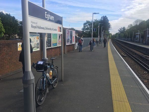
Photo: Martin W
Egham station
| Postcode | TW20 9LB |
|---|
Transport
| Nearby stations | |
|---|---|
| Bus stops |
Egham Railway Station (NW)
Egham Shops (SW)
Egham Shops (NE)
Church Road (SE)
Church Road (NW)
Whitehall Lane (NE)
|
| Station code (TLC) | EGH |
| Station code (NLC) | 5669 |
| Owner | South Western Railway |
| National Rail Enquiries | |
Live Departures
Live Arrivals
Usage
Entries and exits
Interchanges
| Year | Entries and exits | Annual change % | Interchanges | Annual change % |
|---|---|---|---|---|
| 2023 | 1,559,344 | 23.6 % | ||
| 2022 | 1,262,002 | 190.5 % | ||
| 2021 | 434,430 | -77.5 % | ||
| 2020 | 1,928,992 | -6.9 % | ||
| 2019 | 2,072,838 | 2.4 % | ||
| 2018 | 2,024,932 | -2.4 % | ||
| 2017 | 2,075,204 | -1.2 % | ||
| 2016 | 2,101,150 | -1.0 % | ||
| 2015 | 2,121,684 | 1.1 % | ||
| 2014 | 2,098,878 | 0.1 % | ||
| 2013 | 2,096,452 | -2.1 % | ||
| 2012 | 2,141,904 | 3.5 % | ||
| 2011 | 2,069,282 | -0.2 % | ||
| 2010 | 2,072,946 | -2.9 % | ||
| 2009 | 2,134,388 | 5.5 % | ||
| 2008 | 2,023,075 | 25.5 % | ||
| 2007 | 1,611,558 | 6.9 % | ||
| 2006 | 1,507,099 | 2.1 % | ||
| 2005 | 1,475,611 |
Note: Data is for financial years, so 2020 is April 2019 to March 2020
Geography
| Latitude | 51.429646 | |
|---|---|---|
| Longitude | -0.546512 | |
| Easting | 501143 | |
| Northing | 171073 | |
| Grid reference | TQ011710 | |
| UTM reference | 30U 670553 5700460 | |
| what3words | ||
| Plus code | ||
| Distance away |
Postcodes
This map shows the postcodes where this station is the nearest to the postcode (as the crow flies)