Map of Leatherhead station
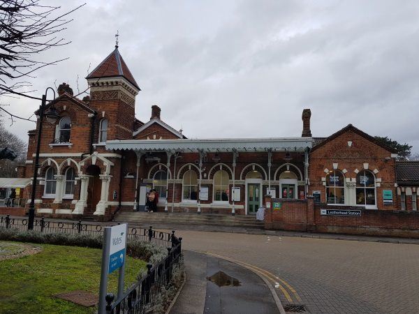
Leatherhead station
| Postcode | KT22 7SQ |
|---|
Transport
| Nearby stations | |
|---|---|
| Bus stops |
Park Rise (N)
Park Rise (S)
North Street (W)
Leret Way (E)
Leret Way (W)
North Street (SE)
|
| Station code (TLC) | LHD |
| Station code (NLC) | 5368 |
| Owner | Govia Thameslink Railway (Southern) |
| National Rail Enquiries | |
Live Departures
Live Arrivals
Usage
Entries and exits
Interchanges
| Year | Entries and exits | Annual change % | Interchanges | Annual change % |
|---|---|---|---|---|
| 2023 | 1,184,542 | 27.5 % | 15,946 | -20.0 % |
| 2022 | 928,998 | 143.1 % | 19,938 | 138.0 % |
| 2021 | 382,184 | -80.4 % | 8,378 | -76.8 % |
| 2020 | 1,951,620 | -5.4 % | 36,175 | -33.7 % |
| 2019 | 2,062,214 | 5.0 % | 54,551 | 1.0 % |
| 2018 | 1,964,658 | -3.1 % | 53,986 | -0.5 % |
| 2017 | 2,026,516 | -6.7 % | 54,270 | -6.6 % |
| 2016 | 2,171,492 | 1.1 % | 58,127 | -8.1 % |
| 2015 | 2,147,876 | 2.1 % | 63,222 | 6.8 % |
| 2014 | 2,104,686 | 0.0 % | 59,218 | -12.7 % |
| 2013 | 2,103,752 | 2.9 % | 67,847 | 15.9 % |
| 2012 | 2,044,148 | 3.4 % | 58,536 | 8.2 % |
| 2011 | 1,977,566 | 5.4 % | 54,118 | -6.8 % |
| 2010 | 1,875,568 | -0.3 % | 58,069 | 0.7 % |
| 2009 | 1,882,144 | 3.2 % | 57,667 | 53.9 % |
| 2008 | 1,824,572 | 15.2 % | 37,464 | -52.9 % |
| 2007 | 1,584,422 | 12.1 % | 79,604 | 32.1 % |
| 2006 | 1,413,955 | 5.7 % | 60,247 | 0.6 % |
| 2005 | 1,338,133 | 59,861 |
Note: Data is for financial years, so 2020 is April 2019 to March 2020
Geography
| Latitude | 51.298817 | |
|---|---|---|
| Longitude | -0.333232 | |
| Easting | 516300 | |
| Northing | 156840 | |
| Grid reference | TQ162568 | |
| UTM reference | 30U 685906 5686432 | |
| what3words | ||
| Plus code | ||
| Distance away |
Postcodes
This map shows the postcodes where this station is the nearest to the postcode (as the crow flies)