Map of Martins Heron station
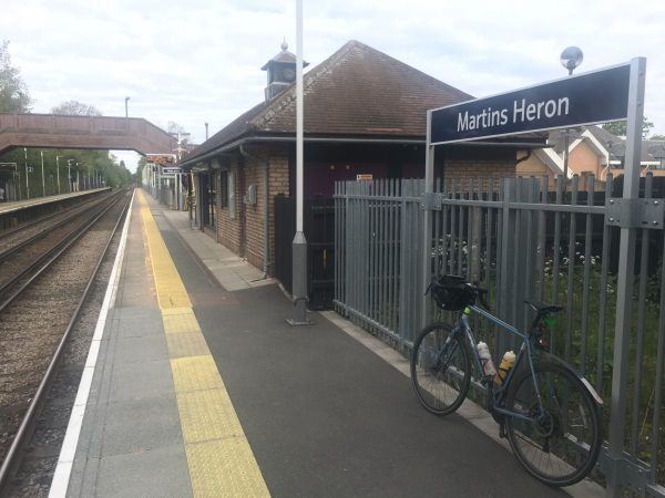
Photo: Martin W
Martins Heron station
| Postcode | RG12 9TZ |
|---|
Transport
| Nearby stations | |
|---|---|
| Bus stops |
Allsmoor Lane (W)
Allsmoor Lane (E)
Drovers Way (E)
Drovers Way (W)
Mendip Road (E)
|
| Station code (TLC) | MAO |
| Station code (NLC) | 5692 |
| Owner | South Western Railway |
| National Rail Enquiries | |
Live Departures
Live Arrivals
Usage
Entries and exits
Interchanges
| Year | Entries and exits | Annual change % | Interchanges | Annual change % |
|---|---|---|---|---|
| 2023 | 346,216 | 14.6 % | ||
| 2022 | 302,110 | 147.6 % | ||
| 2021 | 122,026 | -76.1 % | ||
| 2020 | 510,588 | -7.9 % | ||
| 2019 | 554,178 | -2.3 % | ||
| 2018 | 567,372 | -3.2 % | ||
| 2017 | 586,230 | -0.4 % | ||
| 2016 | 588,416 | 0.7 % | ||
| 2015 | 584,142 | 4.0 % | ||
| 2014 | 561,760 | 4.4 % | ||
| 2013 | 538,238 | 3.2 % | ||
| 2012 | 521,552 | 1.7 % | ||
| 2011 | 512,940 | 0.8 % | ||
| 2010 | 508,856 | -2.0 % | ||
| 2009 | 519,288 | -5.3 % | ||
| 2008 | 548,409 | -2.9 % | ||
| 2007 | 564,743 | 6.7 % | ||
| 2006 | 529,092 | 1.1 % | ||
| 2005 | 523,356 |
Note: Data is for financial years, so 2020 is April 2019 to March 2020
Geography
| Latitude | 51.407411 | |
|---|---|---|
| Longitude | -0.724397 | |
| Easting | 488820 | |
| Northing | 168370 | |
| Grid reference | SU888683 | |
| UTM reference | 30U 658266 5697589 | |
| what3words | ||
| Plus code | ||
| Distance away |
Postcodes
This map shows the postcodes where this station is the nearest to the postcode (as the crow flies)