Map of Reading West station
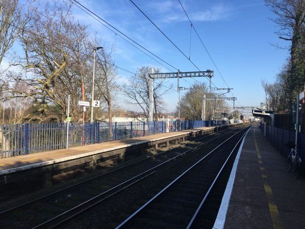
Photo: Martin W
Reading West station
| Postcode | RG1 7PY |
|---|
Transport
| Nearby stations | |
|---|---|
| Bus stops |
Reading West Rail Station - Oxford Road (E)
The Rose and Thistle (W)
George Street (W)
Reading West Station - Tilehurst Road (E)
Maitland Road (W)
Beresford Road (SE)
|
| Station code (TLC) | RDW |
| Station code (NLC) | 3160 |
| Owner | Great Western Railway |
| National Rail Enquiries | |
Live Departures
Live Arrivals
Usage
Entries and exits
Interchanges
| Year | Entries and exits | Annual change % | Interchanges | Annual change % |
|---|---|---|---|---|
| 2023 | 289,840 | 3.2 % | 13,464 | 43.5 % |
| 2022 | 280,732 | 109.2 % | 9,382 | 196.4 % |
| 2021 | 134,182 | -67.1 % | 3,165 | -75.0 % |
| 2020 | 407,238 | -9.0 % | 12,659 | 9.7 % |
| 2019 | 447,416 | 3.1 % | 11,544 | -21.2 % |
| 2018 | 434,004 | -0.1 % | 14,658 | 23.6 % |
| 2017 | 434,612 | 5.3 % | 11,855 | 29.9 % |
| 2016 | 412,642 | 7.1 % | 9,126 | 42.3 % |
| 2015 | 385,332 | -36.9 % | 6,412 | -8.9 % |
| 2014 | 610,814 | 6.5 % | 7,035 | -10.4 % |
| 2013 | 573,490 | 3.0 % | 7,852 | 5.0 % |
| 2012 | 556,976 | 25.4 % | 7,476 | 13.9 % |
| 2011 | 444,163 | -5.4 % | 6,564 | 9.2 % |
| 2010 | 469,481 | 6.2 % | 6,011 | 6.4 % |
| 2009 | 441,871 | -0.3 % | 5,647 | 27.5 % |
| 2008 | 443,098 | 198.8 % | 4,429 | -30.6 % |
| 2007 | 148,309 | -3.3 % | 6,381 | 12.1 % |
| 2006 | 153,334 | 0.6 % | 5,690 | 11.1 % |
| 2005 | 152,400 | 5,122 |
Note: Data is for financial years, so 2020 is April 2019 to March 2020
Geography
| Latitude | 51.455501 | |
|---|---|---|
| Longitude | -0.990129 | |
| Easting | 470264 | |
| Northing | 173430 | |
| Grid reference | SU702734 | |
| UTM reference | 30U 639640 5702396 | |
| what3words | ||
| Plus code | ||
| Distance away |
Postcodes
This map shows the postcodes where this station is the nearest to the postcode (as the crow flies)