Map of Tilehurst station
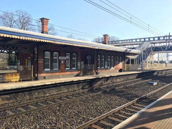
Photo: Martin W
Tilehurst station
| Postcode | RG31 6TH |
|---|
Transport
| Nearby stations | |
|---|---|
| Bus stops |
Tilehurst Station (NW)
Tilehurst Station (SE)
Overlanders End (E)
Oak Tree Road (NE)
Overlanders End (W)
Oak Tree Road (S)
|
| Station code (TLC) | TLH |
| Station code (NLC) | 3154 |
| Owner | Great Western Railway |
| National Rail Enquiries | |
Live Departures
Live Arrivals
Usage
Entries and exits
Interchanges
| Year | Entries and exits | Annual change % | Interchanges | Annual change % |
|---|---|---|---|---|
| 2023 | 320,010 | 32.7 % | ||
| 2022 | 241,228 | 162.4 % | ||
| 2021 | 91,930 | -83.9 % | ||
| 2020 | 572,258 | -3.5 % | ||
| 2019 | 592,760 | 7.9 % | ||
| 2018 | 549,370 | -0.4 % | ||
| 2017 | 551,794 | 3.5 % | ||
| 2016 | 533,300 | -2.4 % | ||
| 2015 | 546,658 | 5.5 % | ||
| 2014 | 518,302 | 3.4 % | ||
| 2013 | 501,120 | -1.0 % | ||
| 2012 | 506,156 | 7.3 % | ||
| 2011 | 471,606 | 6.8 % | ||
| 2010 | 441,548 | 1.0 % | ||
| 2009 | 437,362 | 9.0 % | ||
| 2008 | 401,353 | 0.0 % | ||
| 2007 | 401,248 | 2.1 % | ||
| 2006 | 393,012 | -2.9 % | ||
| 2005 | 404,949 |
Note: Data is for financial years, so 2020 is April 2019 to March 2020
Geography
| Latitude | 51.471509 | |
|---|---|---|
| Longitude | -1.029816 | |
| Easting | 467483 | |
| Northing | 175173 | |
| Grid reference | SU674751 | |
| UTM reference | 30U 636835 5704101 | |
| what3words | ||
| Plus code | ||
| Distance away |
Postcodes
This map shows the postcodes where this station is the nearest to the postcode (as the crow flies)