Map of Woking station
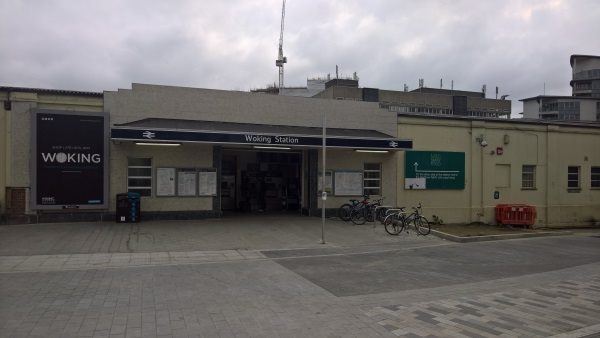
Woking station
| Postcode | GU22 7AE |
|---|
Transport
| Nearby stations | |
|---|---|
| Bus stops |
Woking Railway Station (SW)
Oriental Road Post Office (NE)
Woking Railway Station (N)
Heathside Crescent (SW)
Woking Community Hospital (E)
Woking Community Hospital (W)
|
| Station code (TLC) | WOK |
| Station code (NLC) | 5685 |
| Owner | South Western Railway |
| National Rail Enquiries | |
Live Departures
Live Arrivals
Usage
Entries and exits
Interchanges
| Year | Entries and exits | Annual change % | Interchanges | Annual change % |
|---|---|---|---|---|
| 2023 | 5,322,446 | 30.8 % | 944,832 | 30.2 % |
| 2022 | 4,070,300 | 168.3 % | 725,465 | 175.2 % |
| 2021 | 1,517,284 | -79.4 % | 263,638 | -78.6 % |
| 2020 | 7,352,236 | -4.9 % | 1,231,907 | -13.5 % |
| 2019 | 7,729,100 | 1.1 % | 1,424,174 | 3.1 % |
| 2018 | 7,642,076 | -4.4 % | 1,381,032 | -20.4 % |
| 2017 | 7,997,508 | 0.1 % | 1,734,053 | 1.4 % |
| 2016 | 7,989,232 | 0.3 % | 1,709,992 | 2.1 % |
| 2015 | 7,963,172 | 3.4 % | 1,674,450 | 12.8 % |
| 2014 | 7,697,790 | 3.1 % | 1,484,852 | -5.3 % |
| 2013 | 7,462,936 | 1.0 % | 1,567,745 | 10.0 % |
| 2012 | 7,390,398 | 1.8 % | 1,424,796 | -4.8 % |
| 2011 | 7,260,658 | 1.6 % | 1,497,355 | 6.4 % |
| 2010 | 7,144,324 | -4.5 % | 1,406,971 | -6.0 % |
| 2009 | 7,483,604 | -0.4 % | 1,496,442 | 5.6 % |
| 2008 | 7,509,987 | 11.6 % | 1,416,783 | 1.6 % |
| 2007 | 6,731,268 | 6.0 % | 1,393,834 | 11.5 % |
| 2006 | 6,350,068 | 2.4 % | 1,250,208 | 13.8 % |
| 2005 | 6,202,086 | 1,098,350 |
Note: Data is for financial years, so 2020 is April 2019 to March 2020
Geography
| Latitude | 51.318469 | |
|---|---|---|
| Longitude | -0.55696 | |
| Easting | 500660 | |
| Northing | 158695 | |
| Grid reference | TQ006586 | |
| UTM reference | 30U 670239 5688074 | |
| what3words | ||
| Plus code | ||
| Distance away |
Postcodes
This map shows the postcodes where this station is the nearest to the postcode (as the crow flies)