Map of Banstead station, London
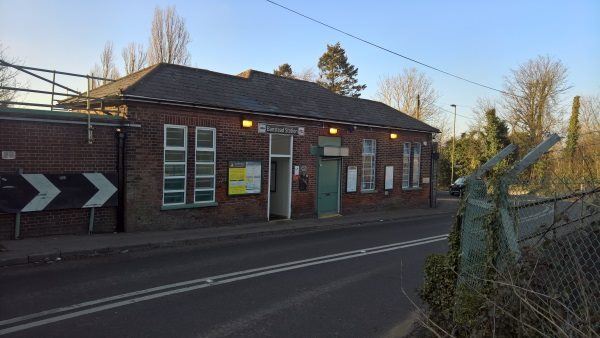
Banstead station
| Postcode | SM7 1RB |
|---|
Transport
| Travel zone | 6 |
|---|---|
| Tube/Rail lines | |
| Next stations | |
| Nearby stations | |
| Bus stops |
Eastgate (S)
Railway Station (W)
Eastgate (N)
Crossroads (W)
Crossroads (S)
Crossroads (E)
|
| Station code (TLC) | BAD |
| Station code (NLC) | 5348 |
| Owner | Govia Thameslink Railway (Southern) |
| National Rail Enquiries | |
Live Departures
Live Arrivals
Usage
Entries and exits
Interchanges
| Year | Entries and exits | Annual change % | Interchanges | Annual change % |
|---|---|---|---|---|
| 2025 | 148,780 | 7.2 % | ||
| 2024 | 138,830 | 20.2 % | ||
| 2023 | 115,472 | 22.1 % | ||
| 2022 | 94,576 | 121.5 % | ||
| 2021 | 42,692 | -71.8 % | ||
| 2020 | 151,414 | 0.1 % | ||
| 2019 | 151,280 | 19.7 % | ||
| 2018 | 126,378 | -11.1 % | ||
| 2017 | 142,128 | -13.1 % | ||
| 2016 | 163,524 | 17.9 % | ||
| 2015 | 138,666 | 5.5 % | ||
| 2014 | 131,382 | -2.8 % | ||
| 2013 | 135,180 | 5.5 % | ||
| 2012 | 128,148 | 10.8 % | ||
| 2011 | 115,680 | 7.0 % | ||
| 2010 | 108,084 | -6.0 % | ||
| 2009 | 115,030 | 8.9 % | ||
| 2008 | 105,664 | 9.8 % | ||
| 2007 | 96,248 | 0.1 % | ||
| 2006 | 96,173 | 3.3 % | ||
| 2005 | 93,069 |
Note: Data is for financial years, so 2020 is April 2019 to March 2020
Geography
| Latitude | 51.329347 | |
|---|---|---|
| Longitude | -0.213159 | |
| Easting | 524590 | |
| Northing | 160426 | |
| Grid reference | TQ245604 | |
| UTM reference | 30U 694147 5690138 | |
| what3words | ||
| Plus code | ||
| Distance away |
Postcodes
This map shows the postcodes where this station is the nearest to the postcode (as the crow flies)