Map of Burnham station, London
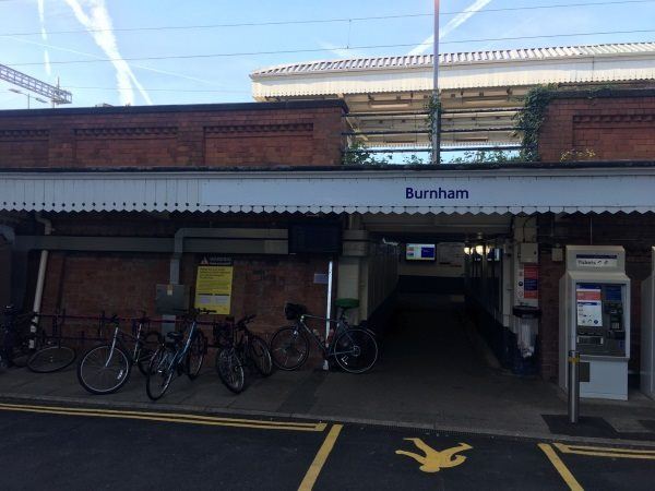
Photo: Martin W
Burnham station
| Postcode | SL1 6JT |
|---|
Transport
| Travel zone | Outside zone 6 |
|---|---|
| Tube/Rail lines | |
| Next stations | |
| Nearby stations | |
| Bus stops |
Burnham Railway Station (SE)
Everitts Corner (W)
Crosthwaite Way (SE)
Everitts Corner (E)
Crosthwaite Way (N)
St Andrews Way (E)
|
| Station code (TLC) | BNM |
| Station code (NLC) | 3176 |
| Owner | TfL Rail |
| National Rail Enquiries | |
Live Departures
Live Arrivals
Usage
Entries and exits
Interchanges
| Year | Entries and exits | Annual change % | Interchanges | Annual change % |
|---|---|---|---|---|
| 2025 | 1,725,890 | 10.2 % | ||
| 2024 | 1,566,076 | 24.5 % | ||
| 2023 | 1,257,832 | 36.8 % | ||
| 2022 | 919,150 | 136.7 % | ||
| 2021 | 388,348 | -72.4 % | ||
| 2020 | 1,408,170 | 0.8 % | ||
| 2019 | 1,396,596 | 10.8 % | ||
| 2018 | 1,260,118 | -4.4 % | ||
| 2017 | 1,317,976 | 1.6 % | ||
| 2016 | 1,297,344 | 1.0 % | ||
| 2015 | 1,285,000 | 4.8 % | ||
| 2014 | 1,226,532 | 5.7 % | ||
| 2013 | 1,160,278 | 3.9 % | ||
| 2012 | 1,117,070 | 5.5 % | ||
| 2011 | 1,058,996 | 11.8 % | ||
| 2010 | 947,050 | -1.3 % | ||
| 2009 | 959,666 | 4.6 % | ||
| 2008 | 917,630 | 3.9 % | ||
| 2007 | 883,590 | 5.6 % | ||
| 2006 | 836,673 | 1.8 % | ||
| 2005 | 822,267 |
Note: Data is for financial years, so 2020 is April 2019 to March 2020
Geography
| Latitude | 51.523505 | |
|---|---|---|
| Longitude | -0.646374 | |
| Easting | 494007 | |
| Northing | 181378 | |
| Grid reference | SU940813 | |
| UTM reference | 30U 663277 5710669 | |
| what3words | ||
| Plus code | ||
| Distance away |
Postcodes
This map shows the postcodes where this station is the nearest to the postcode (as the crow flies)