Map of Chertsey station
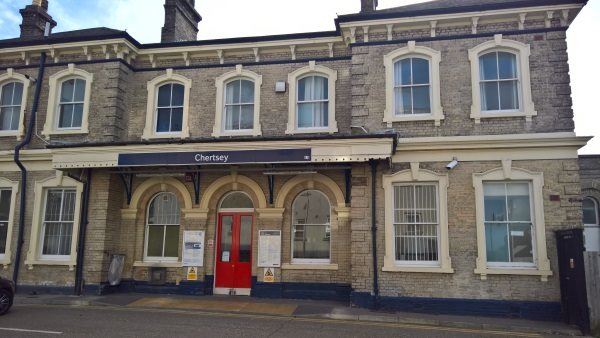
Chertsey station
| Postcode | KT16 9BG |
|---|
Transport
| Nearby stations | |
|---|---|
| Bus stops |
Charles Street (NW)
Sir William Perkins's School (E)
Guildford Street (NE)
Charles Street (SE)
Guildford Street (SW)
Sir William Perkins's School (SW)
|
| Station code (TLC) | CHY |
| Station code (NLC) | 5553 |
| Owner | South Western Railway |
| National Rail Enquiries | |
Live Departures
Live Arrivals
Usage
Entries and exits
Interchanges
| Year | Entries and exits | Annual change % | Interchanges | Annual change % |
|---|---|---|---|---|
| 2025 | 638,340 | 4.9 % | ||
| 2024 | 608,808 | 10.5 % | ||
| 2023 | 551,148 | 11.0 % | ||
| 2022 | 496,676 | 124.2 % | ||
| 2021 | 221,558 | -66.7 % | ||
| 2020 | 665,420 | -8.5 % | ||
| 2019 | 727,072 | 4.3 % | ||
| 2018 | 697,206 | -1.3 % | ||
| 2017 | 706,642 | 4.8 % | ||
| 2016 | 674,418 | -3.1 % | ||
| 2015 | 695,908 | 1.1 % | ||
| 2014 | 688,156 | 12.2 % | ||
| 2013 | 613,244 | 2.7 % | ||
| 2012 | 597,120 | -2.5 % | ||
| 2011 | 612,488 | 1.3 % | ||
| 2010 | 604,808 | -4.3 % | ||
| 2009 | 632,210 | 7.5 % | ||
| 2008 | 587,986 | 36.5 % | ||
| 2007 | 430,757 | 2.7 % | ||
| 2006 | 419,259 | 16.2 % | ||
| 2005 | 360,715 |
Note: Data is for financial years, so 2020 is April 2019 to March 2020
Geography
| Latitude | 51.387068 | |
|---|---|---|
| Longitude | -0.509317 | |
| Easting | 503825 | |
| Northing | 166390 | |
| Grid reference | TQ038663 | |
| UTM reference | 30U 673300 5695813 | |
| what3words | ||
| Plus code | ||
| Distance away |
Postcodes
This map shows the postcodes where this station is the nearest to the postcode (as the crow flies)