Map of Cookham station
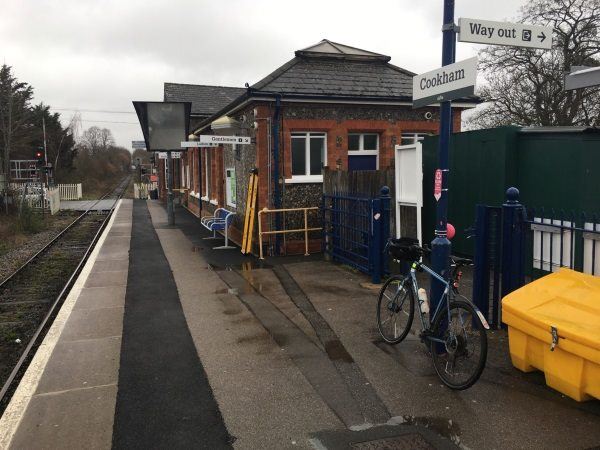
Photo: Martin W
Cookham station
| Postcode | SL6 9BP |
|---|
Transport
| Nearby stations | |
|---|---|
| Bus stops |
Cookham Rise Railway Station (E)
Cedar Drive (N)
Cedar Drive (S)
Medical Centre (E)
Lightlands Lane (SW)
St Elizabeth's Church (NW)
|
| Station code (TLC) | COO |
| Station code (NLC) | 3019 |
| Owner | Great Western Railway |
| National Rail Enquiries | |
Live Departures
Live Arrivals
Usage
Entries and exits
Interchanges
| Year | Entries and exits | Annual change % | Interchanges | Annual change % |
|---|---|---|---|---|
| 2025 | 204,462 | 8.1 % | ||
| 2024 | 189,206 | 24.8 % | ||
| 2023 | 151,602 | 28.5 % | ||
| 2022 | 117,978 | 186.5 % | ||
| 2021 | 41,180 | -81.3 % | ||
| 2020 | 220,664 | -2.7 % | ||
| 2019 | 226,892 | 8.0 % | ||
| 2018 | 210,040 | -2.9 % | ||
| 2017 | 216,336 | -0.7 % | ||
| 2016 | 217,826 | 1.8 % | ||
| 2015 | 213,964 | 3.5 % | ||
| 2014 | 206,654 | -1.6 % | ||
| 2013 | 209,972 | 1.4 % | ||
| 2012 | 207,052 | 2.3 % | ||
| 2011 | 202,488 | 6.4 % | ||
| 2010 | 190,238 | -2.3 % | ||
| 2009 | 194,764 | 2.6 % | ||
| 2008 | 189,804 | -2.7 % | ||
| 2007 | 195,044 | 4.5 % | ||
| 2006 | 186,701 | 3.4 % | ||
| 2005 | 180,647 |
Note: Data is for financial years, so 2020 is April 2019 to March 2020
Geography
| Latitude | 51.557462 | |
|---|---|---|
| Longitude | -0.722079 | |
| Easting | 488690 | |
| Northing | 185060 | |
| Grid reference | SU886850 | |
| UTM reference | 30U 657908 5714278 | |
| what3words | ||
| Plus code | ||
| Distance away |
Postcodes
This map shows the postcodes where this station is the nearest to the postcode (as the crow flies)