Map of Dorking station
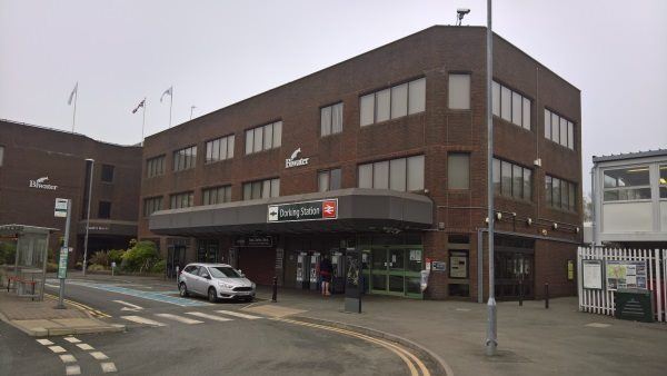
Dorking station
| Postcode | RH4 1TF |
|---|
Transport
| Nearby stations | |
|---|---|
| Bus stops |
Dorking Railway Station (SE)
Dorking Railway Station (SE)
Dorking Railway Station (S)
Dorking Railway Station (N)
Denbies (S)
Deepdene Avenue (SE)
|
| Station code (TLC) | DKG |
| Station code (NLC) | 5357 |
| Owner | Govia Thameslink Railway (Southern) |
| National Rail Enquiries | |
Live Departures
Live Arrivals
Usage
Entries and exits
Interchanges
| Year | Entries and exits | Annual change % | Interchanges | Annual change % |
|---|---|---|---|---|
| 2025 | 834,808 | 9.2 % | 49,192 | -37.9 % |
| 2024 | 764,548 | 10.0 % | 79,175 | 6.0 % |
| 2023 | 695,334 | 0.7 % | 74,693 | 10.5 % |
| 2022 | 690,256 | 163.1 % | 67,622 | 136.6 % |
| 2021 | 262,326 | -77.8 % | 28,575 | -71.0 % |
| 2020 | 1,183,682 | -7.9 % | 98,563 | -8.7 % |
| 2019 | 1,284,546 | -0.2 % | 107,921 | 1.3 % |
| 2018 | 1,287,506 | 10.9 % | 106,498 | -14.6 % |
| 2017 | 1,161,477 | -4.9 % | 124,733 | -8.8 % |
| 2016 | 1,221,252 | -5.5 % | 136,804 | 3.3 % |
| 2015 | 1,292,428 | 2.6 % | 132,373 | 11.0 % |
| 2014 | 1,259,983 | 2.1 % | 119,292 | 5.9 % |
| 2013 | 1,234,007 | -5.0 % | 112,673 | 6.4 % |
| 2012 | 1,299,522 | 9.5 % | 105,887 | 40.2 % |
| 2011 | 1,186,717 | 10.7 % | 75,499 | 19.7 % |
| 2010 | 1,071,978 | -6.1 % | 63,088 | 0.5 % |
| 2009 | 1,141,369 | 5.8 % | 62,772 | -8.1 % |
| 2008 | 1,078,494 | -20.8 % | 68,268 | 21.0 % |
| 2007 | 1,362,275 | 6.5 % | 56,423 | 13.1 % |
| 2006 | 1,279,034 | 3.3 % | 49,901 | 22.0 % |
| 2005 | 1,238,425 | 40,916 |
Note: Data is for financial years, so 2020 is April 2019 to March 2020
Geography
| Latitude | 51.240929 | |
|---|---|---|
| Longitude | -0.324251 | |
| Easting | 517073 | |
| Northing | 150417 | |
| Grid reference | TQ170504 | |
| UTM reference | 30U 686767 5680019 | |
| what3words | ||
| Plus code | ||
| Distance away |
Postcodes
This map shows the postcodes where this station is the nearest to the postcode (as the crow flies)