Map of Dorking West station
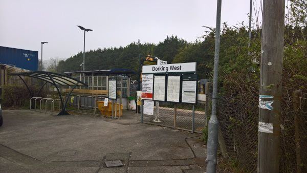
Dorking West station
| Postcode | RH4 5EE |
|---|
Transport
| Nearby stations | |
|---|---|
| Bus stops |
Glebe Road (SW)
West Street (E)
Sondes Place Drive (NE)
|
| Station code (TLC) | DKT |
| Station code (NLC) | 5297 |
| Owner | Great Western Railway |
| National Rail Enquiries | |
Live Departures
Live Arrivals
Usage
Entries and exits
Interchanges
| Year | Entries and exits | Annual change % | Interchanges | Annual change % |
|---|---|---|---|---|
| 2023 | 33,452 | 0.5 % | 249 | 21.5 % |
| 2022 | 33,278 | 163.1 % | 205 | 105.0 % |
| 2021 | 12,648 | -77.8 % | 100 | -72.5 % |
| 2020 | 57,066 | -7.9 % | 364 | -24.0 % |
| 2019 | 61,928 | -0.2 % | 479 | -0.6 % |
| 2018 | 62,072 | 10.9 % | 482 | -35.2 % |
| 2017 | 55,995 | -4.9 % | 744 | -30.5 % |
| 2016 | 58,877 | -5.5 % | 1,070 | -34.7 % |
| 2015 | 62,308 | 9.4 % | 1,639 | |
| 2014 | 56,948 | 2.1 % | ||
| 2013 | 55,774 | 348487.5 % | ||
| 2012 | 16 | -27.3 % | ||
| 2011 | 22 | -98.8 % | ||
| 2010 | 1,810 | 1640.4 % | ||
| 2009 | 104 | 100.0 % | ||
| 2008 | 52 | -34.2 % | ||
| 2007 | 79 | 97.5 % | ||
| 2006 | 40 | 37.9 % | ||
| 2005 | 29 |
Note: Data is for financial years, so 2020 is April 2019 to March 2020
Geography
| Latitude | 51.236225 | |
|---|---|---|
| Longitude | -0.339979 | |
| Easting | 515987 | |
| Northing | 149869 | |
| Grid reference | TQ159498 | |
| UTM reference | 30U 685688 5679456 | |
| what3words | ||
| Plus code | ||
| Distance away |
Postcodes
This map shows the postcodes where this station is the nearest to the postcode (as the crow flies)