Map of Eastbourne station
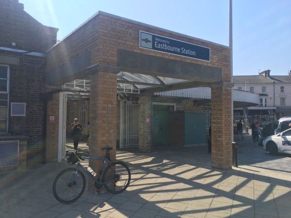
Photo: Martin W
Eastbourne station
| Postcode | BN21 3QJ |
|---|
Transport
| Nearby stations | |
|---|---|
| Bus stops |
Railway Station (NE)
Gildredge Road (N)
Railway Station (E)
Gildredge Road (N)
Library (SW)
Gildredge Road (N)
|
| Station code (TLC) | EBN |
| Station code (NLC) | 5448 |
| Owner | Govia Thameslink Railway (Southern) |
| National Rail Enquiries | |
Live Departures
Live Arrivals
Usage
Entries and exits
Interchanges
| Year | Entries and exits | Annual change % | Interchanges | Annual change % |
|---|---|---|---|---|
| 2025 | 3,754,614 | 7.8 % | 19,169 | 4.1 % |
| 2024 | 3,481,472 | 8.7 % | 18,408 | -53.8 % |
| 2023 | 3,201,528 | 18.7 % | 39,871 | 13.6 % |
| 2022 | 2,696,318 | 127.0 % | 35,101 | 184.4 % |
| 2021 | 1,187,660 | -67.1 % | 12,344 | -79.7 % |
| 2020 | 3,604,628 | 0.7 % | 60,883 | -0.8 % |
| 2019 | 3,580,630 | 6.7 % | 61,373 | 649.8 % |
| 2018 | 3,355,248 | 5.0 % | 8,185 | 17.1 % |
| 2017 | 3,194,804 | -14.9 % | 6,987 | -22.7 % |
| 2016 | 3,754,050 | 0.0 % | 9,042 | -9.9 % |
| 2015 | 3,752,734 | 1.6 % | 10,039 | -8.6 % |
| 2014 | 3,693,060 | 2.9 % | 10,983 | -58.0 % |
| 2013 | 3,588,880 | -0.2 % | 26,138 | -32.3 % |
| 2012 | 3,594,554 | 1.7 % | 38,587 | 64.7 % |
| 2011 | 3,534,536 | 4.8 % | 23,424 | -55.3 % |
| 2010 | 3,371,982 | -4.0 % | 52,415 | 443.5 % |
| 2009 | 3,513,854 | -0.9 % | 9,644 | 28.0 % |
| 2008 | 3,545,125 | 8.3 % | 7,537 | 7.5 % |
| 2007 | 3,272,506 | 6.2 % | 7,009 | 12.4 % |
| 2006 | 3,080,715 | 0.5 % | 6,238 | 59.6 % |
| 2005 | 3,065,020 | 3,908 |
Note: Data is for financial years, so 2020 is April 2019 to March 2020
Geography
| Latitude | 50.769376 | |
|---|---|---|
| Longitude | 0.281247 | |
| Easting | 560959 | |
| Northing | 99124 | |
| Grid reference | TV609991 | |
| UTM reference | 31U 308296 5627703 | |
| what3words | ||
| Plus code | ||
| Distance away |
Postcodes
This map shows the postcodes where this station is the nearest to the postcode (as the crow flies)