Map of Epsom station, London
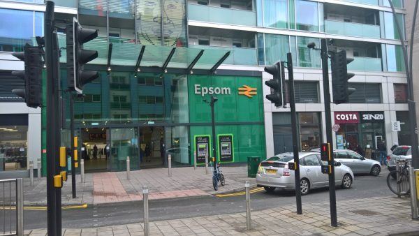
Epsom station
| Postcode | KT19 8EW |
|---|
Transport
| Travel zone | 9 |
|---|---|
| Tube/Rail lines | |
| Next stations | |
| Nearby stations | |
| Bus stops |
Epsom Railway Station (NW)
Clock Tower (E)
Clock Tower (E)
Clock Tower (E)
Waterloo Road (S)
High Street (W)
|
| Station code (TLC) | EPS |
| Station code (NLC) | 5360 |
| Owner | Govia Thameslink Railway (Southern) |
| National Rail Enquiries | |
Live Departures
Live Arrivals
Usage
Entries and exits
Interchanges
| Year | Entries and exits | Annual change % | Interchanges | Annual change % |
|---|---|---|---|---|
| 2025 | 3,342,368 | 6.6 % | 117,631 | 1.5 % |
| 2024 | 3,135,066 | 8.6 % | 115,837 | 2.2 % |
| 2023 | 2,886,954 | 23.7 % | 113,345 | -10.1 % |
| 2022 | 2,334,196 | 141.5 % | 126,011 | 117.7 % |
| 2021 | 966,538 | -75.6 % | 57,889 | -76.6 % |
| 2020 | 3,955,930 | -0.6 % | 247,665 | -12.9 % |
| 2019 | 3,981,152 | 1.6 % | 284,449 | 47.7 % |
| 2018 | 3,918,526 | -3.5 % | 192,629 | -2.7 % |
| 2017 | 4,059,314 | -3.0 % | 197,917 | -11.7 % |
| 2016 | 4,183,184 | 1.6 % | 224,195 | 4.6 % |
| 2015 | 4,116,624 | 3.9 % | 214,336 | -2.7 % |
| 2014 | 3,962,714 | 5.9 % | 220,288 | 10.2 % |
| 2013 | 3,740,752 | 3.0 % | 199,872 | 4.8 % |
| 2012 | 3,633,032 | 0.6 % | 190,680 | 11.7 % |
| 2011 | 3,611,680 | 1.6 % | 170,783 | -10.2 % |
| 2010 | 3,553,416 | -4.7 % | 190,239 | -6.1 % |
| 2009 | 3,728,138 | 0.2 % | 202,507 | 13.3 % |
| 2008 | 3,720,782 | 8.5 % | 178,806 | -22.6 % |
| 2007 | 3,428,523 | 4.5 % | 230,892 | 31.3 % |
| 2006 | 3,280,805 | 0.4 % | 175,856 | 4.6 % |
| 2005 | 3,269,185 | 168,095 |
Note: Data is for financial years, so 2020 is April 2019 to March 2020
Geography
| Latitude | 51.334391 | |
|---|---|---|
| Longitude | -0.268778 | |
| Easting | 520700 | |
| Northing | 160900 | |
| Grid reference | TQ207609 | |
| UTM reference | 30U 690252 5690553 | |
| what3words | ||
| Plus code | ||
| Distance away |
Postcodes
This map shows the postcodes where this station is the nearest to the postcode (as the crow flies)