Map of Hackbridge station, London
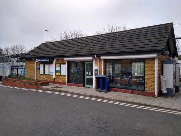
Hackbridge station
| Postcode | SM6 7BJ |
|---|
Transport
| Travel zone | 4 |
|---|---|
| Tube/Rail lines | |
| Next stations | |
| Nearby stations | |
| Bus stops |
Park Road (SM6) (S)
Hackbridge Corner Hackbridge Station (S)
Park Road (SM6) (N)
Hackbridge Corner (NE)
Corbet Close (N)
Beddington Park (N)
|
| Station code (TLC) | HCB |
| Station code (NLC) | 5364 |
| Owner | Govia Thameslink Railway (Southern) |
| National Rail Enquiries | |
Live Departures
Live Arrivals
Usage
Entries and exits
Interchanges
| Year | Entries and exits | Annual change % | Interchanges | Annual change % |
|---|---|---|---|---|
| 2025 | 911,110 | 7.9 % | ||
| 2024 | 844,538 | 17.0 % | ||
| 2023 | 721,954 | 27.6 % | ||
| 2022 | 565,734 | 111.5 % | ||
| 2021 | 267,510 | -72.2 % | ||
| 2020 | 960,934 | 6.0 % | ||
| 2019 | 906,394 | 6.5 % | ||
| 2018 | 850,954 | 3.8 % | ||
| 2017 | 819,780 | -9.3 % | ||
| 2016 | 904,112 | -9.5 % | ||
| 2015 | 998,924 | 6.0 % | ||
| 2014 | 942,142 | 5.8 % | ||
| 2013 | 890,318 | -0.2 % | ||
| 2012 | 891,950 | 7.7 % | ||
| 2011 | 828,022 | 0.7 % | ||
| 2010 | 822,308 | -5.8 % | ||
| 2009 | 872,872 | -8.5 % | ||
| 2008 | 954,252 | 21.4 % | ||
| 2007 | 785,899 | 43.0 % | ||
| 2006 | 549,637 | 2.7 % | ||
| 2005 | 535,300 |
Note: Data is for financial years, so 2020 is April 2019 to March 2020
Geography
| Latitude | 51.37787 | |
|---|---|---|
| Longitude | -0.153908 | |
| Easting | 528582 | |
| Northing | 165929 | |
| Grid reference | TQ285659 | |
| UTM reference | 30U 698064 5695691 | |
| what3words | ||
| Plus code | ||
| Distance away |
Postcodes
This map shows the postcodes where this station is the nearest to the postcode (as the crow flies)