Map of Kilburn High Road station, London
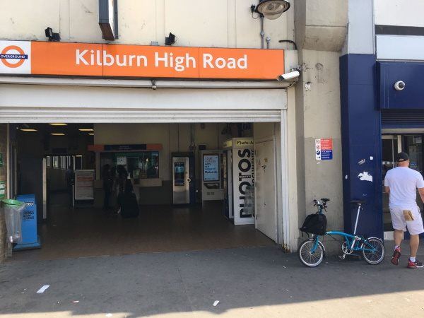
Photo: Martin W
Kilburn High Road station
| Postcode | NW6 7QL |
|---|
Transport
| Travel zone | 2 |
|---|---|
| Tube/Rail lines | |
| Next stations | |
| Nearby stations | |
| Bus stops |
Kilburn High Road Station (W)
Kilburn High Rd Cambridge Ave (S)
Kilburn High Road Station (N)
Kilburn High Road Station (S)
Brondesbury Road (NW6) (N)
Kilburn Park Station (N)
|
| Station code (TLC) | KBN |
| Station code (NLC) | 1415 |
| Owner | London Overground |
| National Rail Enquiries | |
Live Departures
Live Arrivals
Usage
Entries and exits
Interchanges
| Year | Entries and exits | Annual change % | Interchanges | Annual change % |
|---|---|---|---|---|
| 2024 | 661,026 | 2.9 % | ||
| 2023 | 642,316 | 9.5 % | ||
| 2022 | 586,612 | 83.2 % | ||
| 2021 | 320,168 | -57.4 % | ||
| 2020 | 752,218 | -7.7 % | ||
| 2019 | 815,306 | -4.3 % | ||
| 2018 | 851,676 | -8.3 % | ||
| 2017 | 929,190 | 0.5 % | ||
| 2016 | 924,198 | -51.3 % | ||
| 2015 | 1,897,326 | -3.0 % | ||
| 2014 | 1,956,030 | 19.0 % | ||
| 2013 | 1,643,084 | -0.9 % | ||
| 2012 | 1,657,800 | 30.1 % | ||
| 2011 | 1,273,808 | 74.4 % | ||
| 2010 | 730,484 | 5.9 % | ||
| 2009 | 689,882 | 12.8 % | ||
| 2008 | 611,752 | 48.0 % | ||
| 2007 | 413,360 | 600.1 % | ||
| 2006 | 59,041 | -14.8 % | ||
| 2005 | 69,276 |
Note: Data is for financial years, so 2020 is April 2019 to March 2020
Geography
| Latitude | 51.537276 | |
|---|---|---|
| Longitude | -0.192237 | |
| Easting | 525553 | |
| Northing | 183591 | |
| Grid reference | TQ255835 | |
| UTM reference | 30U 694717 5713311 | |
| what3words | ||
| Plus code | ||
| Distance away |
Postcodes
This map shows the postcodes where this station is the nearest to the postcode (as the crow flies)