Map of Langley station, London
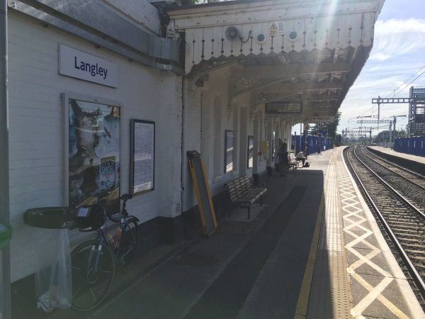
Photo: Martin W
Langley station
| Postcode | SL3 6DB |
|---|
Transport
| Travel zone | Outside zone 6 |
|---|---|
| Tube/Rail lines | |
| Next stations | |
| Nearby stations | |
| Bus stops |
Langley Business Park (N)
Langley Business Park (S)
Sawyers Green Farm (SW)
Sawyers Green Farm (NE)
Harrow Market (N)
Harrow Market (SE)
|
| Station code (TLC) | LNY |
| Station code (NLC) | 3171 |
| Owner | TfL Rail |
| National Rail Enquiries | |
Live Departures
Live Arrivals
Usage
Entries and exits
Interchanges
| Year | Entries and exits | Annual change % | Interchanges | Annual change % |
|---|---|---|---|---|
| 2025 | 1,153,338 | 10.7 % | ||
| 2024 | 1,042,134 | 35.5 % | ||
| 2023 | 769,282 | 29.7 % | ||
| 2022 | 593,182 | 148.2 % | ||
| 2021 | 238,966 | -73.7 % | ||
| 2020 | 907,692 | 4.9 % | ||
| 2019 | 865,536 | 6.2 % | ||
| 2018 | 815,110 | -0.3 % | ||
| 2017 | 817,586 | 2.6 % | ||
| 2016 | 796,614 | 9.7 % | ||
| 2015 | 726,202 | 2.2 % | ||
| 2014 | 710,440 | -1.6 % | ||
| 2013 | 722,140 | 1.9 % | ||
| 2012 | 708,946 | 5.5 % | ||
| 2011 | 671,854 | 9.4 % | ||
| 2010 | 614,190 | -7.2 % | ||
| 2009 | 661,654 | 1.3 % | ||
| 2008 | 653,345 | 12.2 % | ||
| 2007 | 582,093 | 7.7 % | ||
| 2006 | 540,554 | 12.1 % | ||
| 2005 | 482,403 |
Note: Data is for financial years, so 2020 is April 2019 to March 2020
Geography
| Latitude | 51.508061 | |
|---|---|---|
| Longitude | -0.541756 | |
| Easting | 501299 | |
| Northing | 179800 | |
| Grid reference | TQ012798 | |
| UTM reference | 30U 670591 5709190 | |
| what3words | ||
| Plus code | ||
| Distance away |
Postcodes
This map shows the postcodes where this station is the nearest to the postcode (as the crow flies)