Map of Marylebone station, London
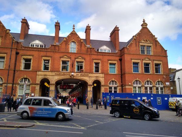
Marylebone station
| Postcode | NW1 6JJ |
|---|
Transport
| Travel zone | 1 |
|---|---|
| Tube/Rail lines | |
| Next stations | |
| Nearby stations | |
| Bus stops |
Marylebone Station (W)
Great Central Street (S)
Marylebone Station (E)
Old Marylebone Town Hall (E)
Dorset Square Marylebone Station (N)
Marylebone Station (W)
|
| Station code (TLC) | MYB |
| Station code (NLC) | 1475 |
| Owner | Chiltern Railways |
| National Rail Enquiries | |
Live Departures
Live Arrivals
Usage
Entries and exits
Interchanges
| Year | Entries and exits | Annual change % | Interchanges | Annual change % |
|---|---|---|---|---|
| 2025 | 11,772,892 | 7.4 % | 1,036,405 | -7.8 % |
| 2024 | 10,966,304 | 6.4 % | 1,124,523 | 51.5 % |
| 2023 | 10,307,792 | 37.6 % | 742,400 | 44.5 % |
| 2022 | 7,488,490 | 268.0 % | 513,896 | 364.7 % |
| 2021 | 2,034,854 | -87.1 % | 110,594 | -87.0 % |
| 2020 | 15,796,118 | -2.2 % | 852,888 | -35.8 % |
| 2019 | 16,146,552 | -3.3 % | 1,328,300 | 90.4 % |
| 2018 | 16,693,466 | 0.2 % | 697,495 | 9.4 % |
| 2017 | 16,666,936 | 4.6 % | 637,394 | 19.3 % |
| 2016 | 15,932,954 | -0.3 % | 534,254 | 7.8 % |
| 2015 | 15,977,862 | 2.9 % | 495,660 | 5.5 % |
| 2014 | 15,520,762 | 5.7 % | 469,630 | -3.9 % |
| 2013 | 14,685,148 | 1.9 % | 488,657 | 11.3 % |
| 2012 | 14,410,072 | 9.2 % | 439,038 | 72.1 % |
| 2011 | 13,200,221 | 12.3 % | 255,104 | -8.0 % |
| 2010 | 11,758,094 | 3.2 % | 277,273 | -16.4 % |
| 2009 | 11,396,645 | -1.4 % | 331,731 | -21.0 % |
| 2008 | 11,559,187 | -0.7 % | 419,968 | 5.5 % |
| 2007 | 11,638,642 | 70.7 % | 398,072 | 43.8 % |
| 2006 | 6,819,287 | -1.9 % | 276,873 | -45.1 % |
| 2005 | 6,949,363 | 504,077 |
Note: Data is for financial years, so 2020 is April 2019 to March 2020
Geography
| Latitude | 51.522522 | |
|---|---|---|
| Longitude | -0.162911 | |
| Easting | 527510 | |
| Northing | 181985 | |
| Grid reference | TQ275819 | |
| UTM reference | 30U 696814 5711750 | |
| what3words | ||
| Plus code | ||
| Distance away |
Postcodes
This map shows the postcodes where this station is the nearest to the postcode (as the crow flies)