Map of Pevensey and Westham station
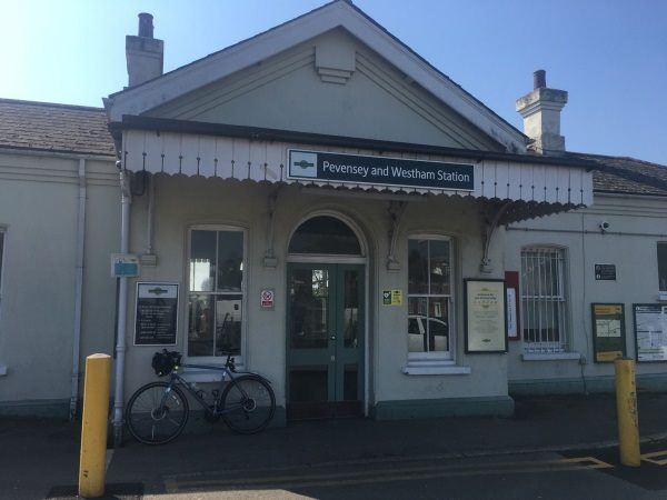
Photo: Martin W
Pevensey and Westham station
| Postcode | BN24 5ND |
|---|
Transport
| Nearby stations | |
|---|---|
| Bus stops |
Crossroads (W)
Crossroads (E)
Hobney Rise (S)
Hobney Rise (N)
Crossroads (S)
Crossroads (N)
|
| Station code (TLC) | PEV |
| Station code (NLC) | 5461 |
| Owner | Govia Thameslink Railway (Southern) |
| National Rail Enquiries | |
Live Departures
Live Arrivals
Usage
Entries and exits
Interchanges
| Year | Entries and exits | Annual change % | Interchanges | Annual change % |
|---|---|---|---|---|
| 2024 | 153,290 | 0.2 % | ||
| 2023 | 152,934 | 7.3 % | ||
| 2022 | 142,574 | 155.7 % | ||
| 2021 | 55,748 | -67.6 % | ||
| 2020 | 172,144 | 5.1 % | ||
| 2019 | 163,808 | 15.8 % | ||
| 2018 | 141,472 | 13.9 % | ||
| 2017 | 124,246 | -24.2 % | ||
| 2016 | 163,996 | -0.7 % | ||
| 2015 | 165,128 | 6.1 % | ||
| 2014 | 155,600 | 3.4 % | ||
| 2013 | 150,510 | -6.9 % | ||
| 2012 | 161,656 | 6.5 % | ||
| 2011 | 151,848 | 12.7 % | ||
| 2010 | 134,744 | -1.0 % | ||
| 2009 | 136,056 | -5.4 % | ||
| 2008 | 143,859 | 5.9 % | ||
| 2007 | 135,882 | 1.3 % | ||
| 2006 | 134,166 | 1.8 % | ||
| 2005 | 131,769 |
Note: Data is for financial years, so 2020 is April 2019 to March 2020
Geography
| Latitude | 50.815797 | |
|---|---|---|
| Longitude | 0.324807 | |
| Easting | 563868 | |
| Northing | 104381 | |
| Grid reference | TQ638043 | |
| UTM reference | 31U 311554 5632752 | |
| what3words | ||
| Plus code | ||
| Distance away |
Postcodes
This map shows the postcodes where this station is the nearest to the postcode (as the crow flies)