Map of South Merton station, London
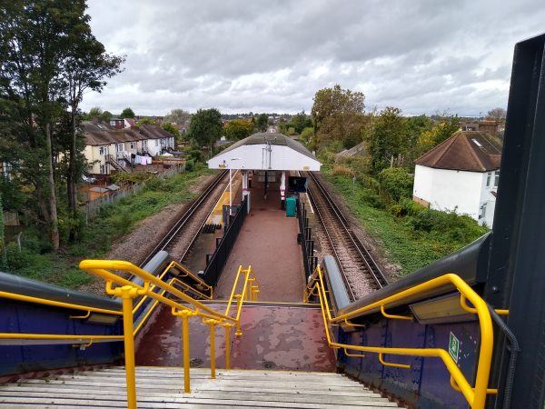
South Merton station
| Postcode | SW20 9JT |
|---|
Transport
| Travel zone | 4 |
|---|---|
| Tube/Rail lines | |
| Next stations | |
| Nearby stations | |
| Bus stops |
South Merton (W)
Ashridge Way South Merton (W)
Maycross Avenue (W)
Maycross Avenue (E)
Kenley Road Mostyn Road (W)
Ashridge Way South Merton (E)
|
| Station code (TLC) | SMO |
| Station code (NLC) | 5292 |
| Owner | Govia Thameslink Railway (Thameslink) |
| National Rail Enquiries | |
Live Departures
Live Arrivals
Usage
Entries and exits
Interchanges
| Year | Entries and exits | Annual change % | Interchanges | Annual change % |
|---|---|---|---|---|
| 2024 | 117,202 | 7.8 % | ||
| 2023 | 108,722 | 21.8 % | ||
| 2022 | 89,286 | 102.2 % | ||
| 2021 | 44,164 | -70.4 % | ||
| 2020 | 149,020 | 30.1 % | ||
| 2019 | 114,538 | -4.3 % | ||
| 2018 | 119,646 | 4.9 % | ||
| 2017 | 114,054 | -18.4 % | ||
| 2016 | 139,816 | -28.0 % | ||
| 2015 | 194,092 | 5.8 % | ||
| 2014 | 183,482 | 16.4 % | ||
| 2013 | 157,632 | 0.4 % | ||
| 2012 | 157,004 | 14.1 % | ||
| 2011 | 137,550 | 10.5 % | ||
| 2010 | 124,534 | -11.9 % | ||
| 2009 | 141,418 | -20.0 % | ||
| 2008 | 176,734 | 51.3 % | ||
| 2007 | 116,795 | 131.6 % | ||
| 2006 | 50,424 | 12.7 % | ||
| 2005 | 44,731 |
Note: Data is for financial years, so 2020 is April 2019 to March 2020
Geography
| Latitude | 51.402992 | |
|---|---|---|
| Longitude | -0.205157 | |
| Easting | 524917 | |
| Northing | 168662 | |
| Grid reference | TQ249686 | |
| UTM reference | 30U 694392 5698347 | |
| what3words | ||
| Plus code | ||
| Distance away |
Postcodes
This map shows the postcodes where this station is the nearest to the postcode (as the crow flies)