Map of Sutton station, London
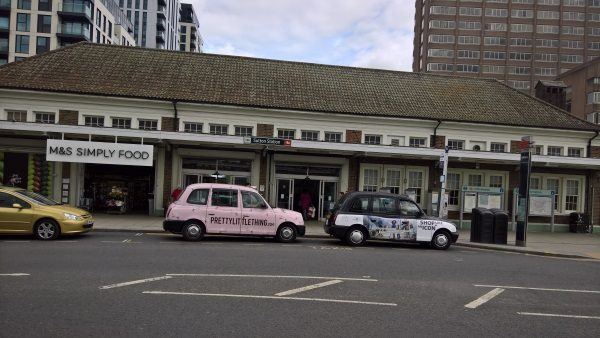
Sutton station
| Postcode | SM1 1JA |
|---|
Transport
| Travel zone | 5 |
|---|---|
| Tube/Rail lines | |
| Next stations | |
| Nearby stations | |
| Bus stops |
Sutton Station (E)
Sutton Station (SW)
Sutton Station The Quadrant (N)
Sutton Station (N)
Sutton Head Post Office (N)
Brighton Road (W)
|
| Station code (TLC) | SUO |
| Station code (NLC) | 5385 |
| Owner | Govia Thameslink Railway (Southern) |
| National Rail Enquiries | |
Live Departures
Live Arrivals
Usage
Entries and exits
Interchanges
| Year | Entries and exits | Annual change % | Interchanges | Annual change % |
|---|---|---|---|---|
| 2025 | 4,639,520 | 3.3 % | 470,441 | 10.4 % |
| 2024 | 4,491,044 | 3.5 % | 426,216 | 18.6 % |
| 2023 | 4,340,262 | 17.6 % | 359,251 | 6.9 % |
| 2022 | 3,692,266 | 105.0 % | 336,060 | 119.6 % |
| 2021 | 1,800,708 | -72.2 % | 153,016 | -75.7 % |
| 2020 | 6,474,958 | -0.2 % | 629,214 | 4.8 % |
| 2019 | 6,488,114 | 2.0 % | 600,361 | 15.1 % |
| 2018 | 6,362,040 | -2.5 % | 521,623 | -2.1 % |
| 2017 | 6,526,152 | -8.2 % | 532,619 | -17.9 % |
| 2016 | 7,111,238 | 4.9 % | 648,534 | 0.6 % |
| 2015 | 6,778,932 | 2.6 % | 644,361 | -1.3 % |
| 2014 | 6,607,180 | 4.0 % | 653,081 | 4.4 % |
| 2013 | 6,353,196 | 4.8 % | 625,320 | 0.7 % |
| 2012 | 6,064,506 | 5.1 % | 620,689 | -12.5 % |
| 2011 | 5,768,694 | 1.4 % | 709,249 | -4.3 % |
| 2010 | 5,687,112 | -6.1 % | 741,451 | 10.5 % |
| 2009 | 6,059,260 | -5.5 % | 671,266 | -3.6 % |
| 2008 | 6,411,175 | 6.1 % | 696,168 | 16.1 % |
| 2007 | 6,042,442 | 27.2 % | 599,728 | 48.5 % |
| 2006 | 4,749,567 | 0.7 % | 403,779 | 5.8 % |
| 2005 | 4,715,606 | 381,567 |
Note: Data is for financial years, so 2020 is April 2019 to March 2020
Geography
| Latitude | 51.359532 | |
|---|---|---|
| Longitude | -0.191215 | |
| Easting | 526028 | |
| Northing | 163823 | |
| Grid reference | TQ260638 | |
| UTM reference | 30U 695547 5693552 | |
| what3words | ||
| Plus code | ||
| Distance away |
Postcodes
This map shows the postcodes where this station is the nearest to the postcode (as the crow flies)