Map of Teddington station, London
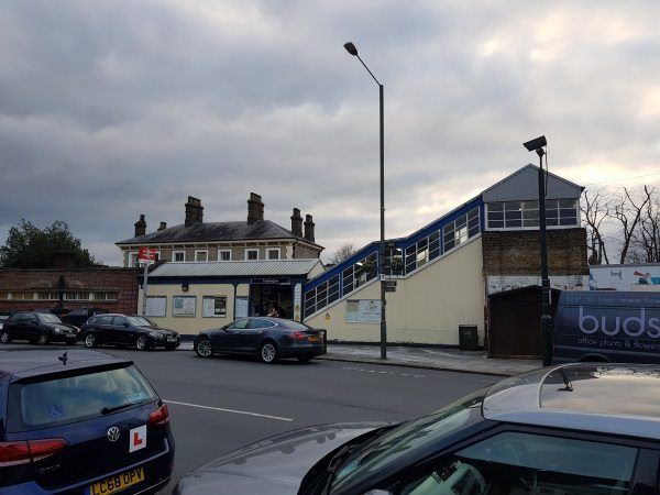
Teddington station
| Postcode | TW11 9AA |
|---|
Transport
| Travel zone | 6 |
|---|---|
| Tube/Rail lines | |
| Next stations | |
| Nearby stations | |
| Bus stops |
Teddington Police Station (N)
Elmfield Avenue (W)
Elmfield Avenue (E)
Maddison Close (S)
Maddison Close (N)
Teddington Library (N)
|
| Station code (TLC) | TED |
| Station code (NLC) | 5572 |
| Owner | South Western Railway |
| National Rail Enquiries | |
Live Departures
Live Arrivals
Usage
Entries and exits
Interchanges
| Year | Entries and exits | Annual change % | Interchanges | Annual change % |
|---|---|---|---|---|
| 2025 | 1,717,082 | 6.5 % | 94,434 | 20.8 % |
| 2024 | 1,611,738 | 16.7 % | 78,169 | 17.8 % |
| 2023 | 1,380,530 | 26.8 % | 66,384 | 42.4 % |
| 2022 | 1,088,744 | 166.6 % | 46,622 | 196.5 % |
| 2021 | 408,402 | -80.2 % | 15,725 | -81.2 % |
| 2020 | 2,060,236 | -7.5 % | 83,525 | -7.6 % |
| 2019 | 2,228,352 | 4.4 % | 90,384 | -3.2 % |
| 2018 | 2,134,778 | -4.4 % | 93,367 | -4.5 % |
| 2017 | 2,234,070 | -4.8 % | 97,805 | -34.2 % |
| 2016 | 2,345,498 | -10.8 % | 148,645 | 12.7 % |
| 2015 | 2,630,766 | 5.4 % | 131,910 | 11.5 % |
| 2014 | 2,495,754 | 2.3 % | 118,301 | -8.5 % |
| 2013 | 2,439,604 | 2.8 % | 129,307 | -1.9 % |
| 2012 | 2,372,256 | 3.1 % | 131,782 | -5.0 % |
| 2011 | 2,301,530 | 3.6 % | 138,674 | 8.1 % |
| 2010 | 2,222,352 | -1.2 % | 128,295 | -4.7 % |
| 2009 | 2,248,516 | -11.2 % | 134,556 | 0.3 % |
| 2008 | 2,530,988 | 9.7 % | 134,181 | -6.4 % |
| 2007 | 2,307,253 | 57.0 % | 143,431 | 171.3 % |
| 2006 | 1,469,222 | -1.0 % | 52,866 | 18.9 % |
| 2005 | 1,483,990 | 44,445 |
Note: Data is for financial years, so 2020 is April 2019 to March 2020
Geography
| Latitude | 51.42448 | |
|---|---|---|
| Longitude | -0.332706 | |
| Easting | 516019 | |
| Northing | 170817 | |
| Grid reference | TQ160708 | |
| UTM reference | 30U 685435 5700405 | |
| what3words | ||
| Plus code | ||
| Distance away |
Postcodes
This map shows the postcodes where this station is the nearest to the postcode (as the crow flies)