Map of Wokingham station
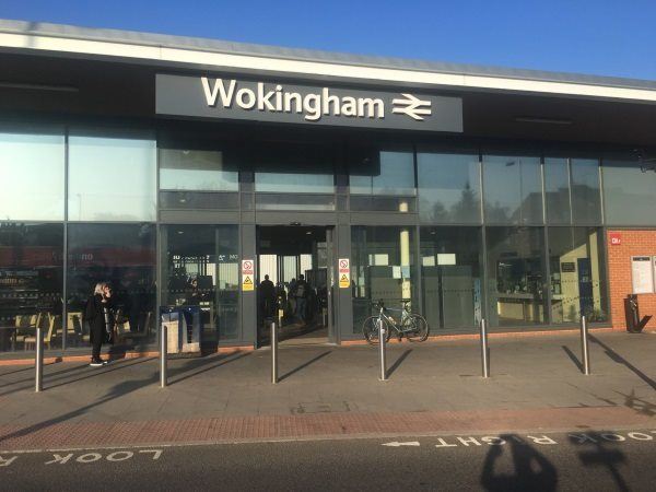
Photo: Martin W
Wokingham station
| Postcode | RG40 2AP |
|---|
Transport
| Nearby stations | |
|---|---|
| Bus stops |
Wokingham Station Interchange (NW)
Wokingham Station (SW)
Wokingham Hospital (SW)
Shute End (SE)
Wokingham Hospital (NE)
Shute End (NW)
|
| Station code (TLC) | WKM |
| Station code (NLC) | 5696 |
| Owner | South Western Railway |
| National Rail Enquiries | |
Live Departures
Live Arrivals
Usage
Entries and exits
Interchanges
| Year | Entries and exits | Annual change % | Interchanges | Annual change % |
|---|---|---|---|---|
| 2025 | 1,902,086 | 15.1 % | 73,552 | 18.6 % |
| 2024 | 1,652,192 | 5.9 % | 62,035 | 18.7 % |
| 2023 | 1,560,326 | 21.8 % | 52,270 | -4.3 % |
| 2022 | 1,281,010 | 164.5 % | 54,616 | 132.7 % |
| 2021 | 484,316 | -79.5 % | 23,467 | -79.1 % |
| 2020 | 2,360,472 | -4.2 % | 112,501 | -14.5 % |
| 2019 | 2,464,906 | 1.7 % | 131,620 | -4.4 % |
| 2018 | 2,423,576 | -0.9 % | 137,735 | -3.2 % |
| 2017 | 2,444,566 | 1.0 % | 142,274 | -21.4 % |
| 2016 | 2,420,218 | 3.2 % | 181,008 | 10.2 % |
| 2015 | 2,344,598 | 5.8 % | 164,264 | -5.3 % |
| 2014 | 2,216,864 | 0.6 % | 173,485 | 7.6 % |
| 2013 | 2,204,046 | 2.5 % | 161,198 | -15.5 % |
| 2012 | 2,149,904 | 2.5 % | 190,689 | 77.5 % |
| 2011 | 2,097,534 | 4.3 % | 107,405 | 1.8 % |
| 2010 | 2,011,224 | -4.5 % | 105,471 | -4.4 % |
| 2009 | 2,106,784 | -0.8 % | 110,323 | 12.2 % |
| 2008 | 2,123,265 | 8.9 % | 98,345 | -14.1 % |
| 2007 | 1,950,524 | 6.1 % | 114,534 | 101.7 % |
| 2006 | 1,838,583 | 2.0 % | 56,778 | 12.0 % |
| 2005 | 1,803,315 | 50,703 |
Note: Data is for financial years, so 2020 is April 2019 to March 2020
Geography
| Latitude | 51.411218 | |
|---|---|---|
| Longitude | -0.842543 | |
| Easting | 480596 | |
| Northing | 168657 | |
| Grid reference | SU805686 | |
| UTM reference | 30U 650037 5697763 | |
| what3words | ||
| Plus code | ||
| Distance away |
Postcodes
This map shows the postcodes where this station is the nearest to the postcode (as the crow flies)