Map of Berrylands station, London
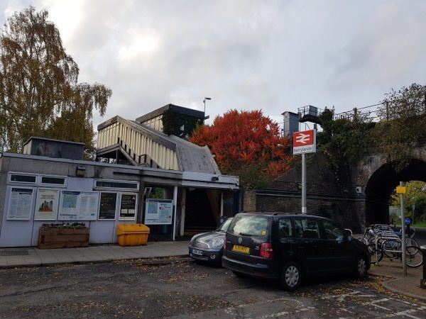
Berrylands station
| Postcode | KT5 8LT |
|---|
Transport
| Travel zone | 5 |
|---|---|
| Tube/Rail lines | |
| Next stations | |
| Nearby stations | |
| Bus stops |
The Berrylands (E)
Pembroke Avenue (E)
Pembroke Avenue (W)
The Roystons (N)
The Roystons (S)
Archdale Place (E)
|
| Station code (TLC) | BRS |
| Station code (NLC) | 5581 |
| Owner | South Western Railway |
| National Rail Enquiries | |
Live Departures
Live Arrivals
Usage
Entries and exits
Interchanges
| Year | Entries and exits | Annual change % | Interchanges | Annual change % |
|---|---|---|---|---|
| 2025 | 363,954 | 7.1 % | ||
| 2024 | 339,932 | 17.9 % | ||
| 2023 | 288,216 | 23.4 % | ||
| 2022 | 233,480 | 164.2 % | ||
| 2021 | 88,366 | -76.3 % | ||
| 2020 | 373,514 | -6.8 % | ||
| 2019 | 400,700 | 4.7 % | ||
| 2018 | 382,688 | 2.1 % | ||
| 2017 | 374,746 | 0.1 % | ||
| 2016 | 374,332 | -7.8 % | ||
| 2015 | 405,862 | 4.3 % | ||
| 2014 | 389,012 | 2.9 % | ||
| 2013 | 378,024 | 1.1 % | ||
| 2012 | 374,062 | 4.2 % | ||
| 2011 | 359,072 | 5.6 % | ||
| 2010 | 339,894 | -9.5 % | ||
| 2009 | 375,638 | 5.8 % | ||
| 2008 | 354,882 | 7.7 % | ||
| 2007 | 329,473 | 88.8 % | ||
| 2006 | 174,464 | -9.0 % | ||
| 2005 | 191,698 |
Note: Data is for financial years, so 2020 is April 2019 to March 2020
Geography
| Latitude | 51.399044 | |
|---|---|---|
| Longitude | -0.280714 | |
| Easting | 519728 | |
| Northing | 168040 | |
| Grid reference | TQ197680 | |
| UTM reference | 30U 689154 5697710 | |
| what3words | ||
| Plus code | ||
| Distance away |
Postcodes
This map shows the postcodes where this station is the nearest to the postcode (as the crow flies)