Map of Farncombe station
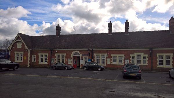
Farncombe station
| Postcode | GU7 3NF |
|---|
Transport
| Nearby stations | |
|---|---|
| Bus stops |
St John's Church (S)
St John's Church (N)
Nursery Road (SW)
Nursery Road (NE)
St John's Street (N)
St John's Street (S)
|
| Station code (TLC) | FNC |
| Station code (NLC) | 5643 |
| Owner | South Western Railway |
| National Rail Enquiries | |
Live Departures
Live Arrivals
Usage
Entries and exits
Interchanges
| Year | Entries and exits | Annual change % | Interchanges | Annual change % |
|---|---|---|---|---|
| 2025 | 568,436 | 16.8 % | ||
| 2024 | 486,764 | 11.4 % | ||
| 2023 | 436,802 | 24.4 % | ||
| 2022 | 351,174 | 155.0 % | ||
| 2021 | 137,736 | -82.3 % | ||
| 2020 | 779,808 | -10.2 % | ||
| 2019 | 868,654 | 0.7 % | ||
| 2018 | 862,414 | -2.6 % | ||
| 2017 | 885,284 | 2.4 % | ||
| 2016 | 864,546 | -0.7 % | ||
| 2015 | 870,668 | 1.2 % | ||
| 2014 | 860,042 | 1.5 % | ||
| 2013 | 847,234 | 2.4 % | ||
| 2012 | 827,290 | 2.6 % | ||
| 2011 | 806,182 | 5.0 % | ||
| 2010 | 767,678 | -0.0 % | ||
| 2009 | 767,710 | 9.4 % | ||
| 2008 | 701,994 | 9.9 % | ||
| 2007 | 638,712 | 9.6 % | ||
| 2006 | 582,757 | -1.7 % | ||
| 2005 | 592,624 |
Note: Data is for financial years, so 2020 is April 2019 to March 2020
Geography
| Latitude | 51.197153 | |
|---|---|---|
| Longitude | -0.604549 | |
| Easting | 497600 | |
| Northing | 145140 | |
| Grid reference | SU975451 | |
| UTM reference | 30U 667364 5674476 | |
| what3words | ||
| Plus code | ||
| Distance away |
Postcodes
This map shows the postcodes where this station is the nearest to the postcode (as the crow flies)