Map of Fratton station
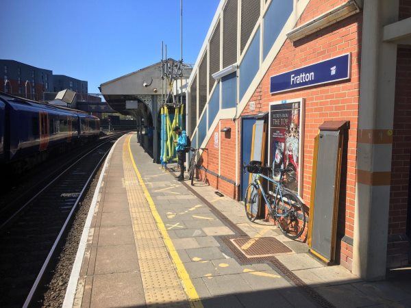
Photo: Martin W
Fratton station
| Postcode | PO1 5AW |
|---|
Transport
| Nearby stations | |
|---|---|
| Bus stops |
Talbot Road (W)
Fratton Bridge (E)
Fratton Bridge (W)
Fratton Bridge (SW)
Priory School (SW)
Priory School (N)
|
| Station code (TLC) | FTN |
| Station code (NLC) | 5509 |
| Owner | South Western Railway |
| National Rail Enquiries | |
Live Departures
Live Arrivals
Usage
Entries and exits
Interchanges
| Year | Entries and exits | Annual change % | Interchanges | Annual change % |
|---|---|---|---|---|
| 2025 | 2,080,340 | 6.4 % | 80,911 | -45.6 % |
| 2024 | 1,955,402 | 10.1 % | 148,616 | -3.6 % |
| 2023 | 1,775,756 | 16.9 % | 154,235 | 111.4 % |
| 2022 | 1,518,994 | 140.6 % | 72,962 | 194.0 % |
| 2021 | 631,428 | -64.5 % | 24,815 | -76.6 % |
| 2020 | 1,778,362 | 2.5 % | 106,007 | 0.5 % |
| 2019 | 1,735,300 | 8.4 % | 105,441 | 69.0 % |
| 2018 | 1,601,022 | 0.3 % | 62,392 | 3.5 % |
| 2017 | 1,595,694 | -7.0 % | 60,290 | -12.1 % |
| 2016 | 1,715,878 | 4.4 % | 68,617 | -9.4 % |
| 2015 | 1,643,624 | 4.7 % | 75,761 | 11.0 % |
| 2014 | 1,570,588 | 1.2 % | 68,238 | 1.7 % |
| 2013 | 1,552,398 | -1.9 % | 67,083 | -1.3 % |
| 2012 | 1,582,690 | 3.4 % | 67,943 | 16.6 % |
| 2011 | 1,530,310 | 3.0 % | 58,270 | -41.0 % |
| 2010 | 1,485,842 | -4.6 % | 98,763 | 3.1 % |
| 2009 | 1,557,636 | 6.4 % | 95,756 | -12.5 % |
| 2008 | 1,464,604 | 7.0 % | 109,474 | 131.3 % |
| 2007 | 1,368,920 | 6.2 % | 47,320 | 38.9 % |
| 2006 | 1,289,130 | 3.5 % | 34,074 | -11.9 % |
| 2005 | 1,246,101 | 38,692 |
Note: Data is for financial years, so 2020 is April 2019 to March 2020
Geography
| Latitude | 50.796339 | |
|---|---|---|
| Longitude | -1.073983 | |
| Easting | 465360 | |
| Northing | 100050 | |
| Grid reference | SU653000 | |
| UTM reference | 30U 635733 5628945 | |
| what3words | ||
| Plus code | ||
| Distance away |
Postcodes
This map shows the postcodes where this station is the nearest to the postcode (as the crow flies)