Map of Frimley station
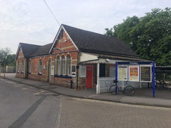
Photo: Martin W
Frimley station
| Postcode | GU16 7QH |
|---|
Transport
| Nearby stations | |
|---|---|
| Bus stops |
Frimley Railway Station (SW)
High Street (NE)
High Street (S)
Lyon Way (SE)
Church Road (SW)
Church Road (NE)
|
| Station code (TLC) | FML |
| Station code (NLC) | 5683 |
| Owner | South Western Railway |
| National Rail Enquiries | |
Live Departures
Live Arrivals
Usage
Entries and exits
Interchanges
| Year | Entries and exits | Annual change % | Interchanges | Annual change % |
|---|---|---|---|---|
| 2025 | 204,590 | 11.5 % | ||
| 2024 | 183,440 | 11.9 % | ||
| 2023 | 163,918 | 16.6 % | ||
| 2022 | 140,544 | 122.9 % | ||
| 2021 | 63,066 | -64.5 % | ||
| 2020 | 177,866 | -13.0 % | ||
| 2019 | 204,340 | 0.7 % | ||
| 2018 | 202,910 | -5.8 % | ||
| 2017 | 215,496 | 0.0 % | ||
| 2016 | 215,418 | 2.5 % | ||
| 2015 | 210,102 | -4.6 % | ||
| 2014 | 220,164 | -2.7 % | ||
| 2013 | 226,258 | 2.9 % | ||
| 2012 | 219,822 | -0.2 % | ||
| 2011 | 220,234 | -2.0 % | ||
| 2010 | 224,614 | -7.3 % | ||
| 2009 | 242,318 | 9.3 % | ||
| 2008 | 221,711 | 11.9 % | ||
| 2007 | 198,063 | 0.0 % | ||
| 2006 | 197,992 | 9.3 % | ||
| 2005 | 181,097 |
Note: Data is for financial years, so 2020 is April 2019 to March 2020
Geography
| Latitude | 51.311861 | |
|---|---|---|
| Longitude | -0.746991 | |
| Easting | 487430 | |
| Northing | 157717 | |
| Grid reference | SU874577 | |
| UTM reference | 30U 657021 5686916 | |
| what3words | ||
| Plus code | ||
| Distance away |
Postcodes
This map shows the postcodes where this station is the nearest to the postcode (as the crow flies)