Map of Herne Hill station, London
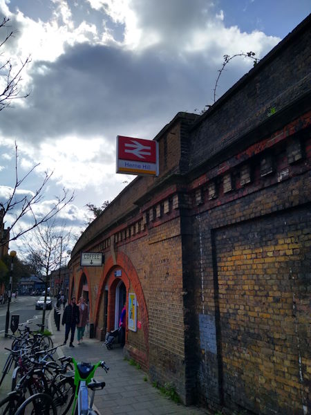
Herne Hill station
| Postcode | SE24 0JW |
|---|
Transport
| Travel zone | 2,3 |
|---|---|
| Tube/Rail lines | |
| Next stations | |
| Nearby stations | |
| Bus stops |
Herne Hill Station (W)
Herne Hill Station (N)
Herne Hill Station (S)
Herne Hill (E)
Brockwell Park (S)
Brockwell Park (N)
|
| Station code (TLC) | HNH |
| Station code (NLC) | 5066 |
| Owner | Southeastern |
| National Rail Enquiries | |
Live Departures
Live Arrivals
Usage
Entries and exits
Interchanges
| Year | Entries and exits | Annual change % | Interchanges | Annual change % |
|---|---|---|---|---|
| 2024 | 2,279,396 | 13.8 % | 1,056,646 | 25.3 % |
| 2023 | 2,003,536 | 24.7 % | 843,160 | 45.1 % |
| 2022 | 1,606,572 | 115.6 % | 581,099 | 124.6 % |
| 2021 | 745,320 | -73.2 % | 258,724 | -83.4 % |
| 2020 | 2,783,754 | -3.6 % | 1,554,023 | 1.1 % |
| 2019 | 2,887,852 | -2.2 % | 1,537,016 | -11.4 % |
| 2018 | 2,952,022 | 2.8 % | 1,734,469 | 4.8 % |
| 2017 | 2,872,992 | -3.3 % | 1,654,799 | -2.0 % |
| 2016 | 2,971,220 | -12.6 % | 1,688,324 | 10.4 % |
| 2015 | 3,397,698 | 2.7 % | 1,529,438 | 5.4 % |
| 2014 | 3,308,970 | 13.4 % | 1,451,516 | 10.4 % |
| 2013 | 2,918,610 | 5.0 % | 1,314,238 | 9.2 % |
| 2012 | 2,779,942 | 5.7 % | 1,203,287 | -23.4 % |
| 2011 | 2,629,368 | 2.5 % | 1,571,136 | -3.6 % |
| 2010 | 2,564,060 | -4.6 % | 1,629,563 | 41.9 % |
| 2009 | 2,686,386 | -4.3 % | 1,147,999 | -22.9 % |
| 2008 | 2,807,629 | 19.3 % | 1,488,664 | 25.8 % |
| 2007 | 2,353,890 | 45.4 % | 1,183,785 | 38.2 % |
| 2006 | 1,618,701 | -1.1 % | 856,704 | 8.3 % |
| 2005 | 1,636,337 | 791,134 |
Note: Data is for financial years, so 2020 is April 2019 to March 2020
Geography
| Latitude | 51.453303 | |
|---|---|---|
| Longitude | -0.102289 | |
| Easting | 531934 | |
| Northing | 174486 | |
| Grid reference | TQ319744 | |
| UTM reference | 30U 701324 5704219 | |
| what3words | ||
| Plus code | ||
| Distance away |
Postcodes
This map shows the postcodes where this station is the nearest to the postcode (as the crow flies)