Map of Kentish Town West station, London
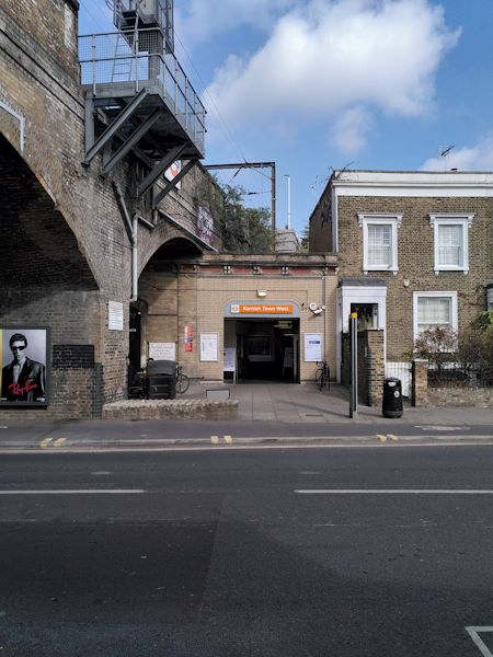
Kentish Town West station
| Postcode | NW5 3LD |
|---|
Transport
| Travel zone | 2 |
|---|---|
| Tube/Rail lines | |
| Next stations | |
| Nearby stations | |
| Bus stops |
Kentish Town West Station (W)
Harmood Street (W)
Ferdinand Street (N)
Prince Of Wales Road Kentish Town (N)
Ferdinand Street (S)
Kentish Town Road (E)
|
| Station code (TLC) | KTW |
| Station code (NLC) | 1449 |
| Owner | London Overground |
| National Rail Enquiries | |
Live Departures
Live Arrivals
Usage
Entries and exits
Interchanges
| Year | Entries and exits | Annual change % | Interchanges | Annual change % |
|---|---|---|---|---|
| 2024 | 1,886,874 | 22.1 % | ||
| 2023 | 1,545,368 | 14.9 % | ||
| 2022 | 1,344,784 | 91.6 % | ||
| 2021 | 701,942 | -62.4 % | ||
| 2020 | 1,865,960 | -9.0 % | ||
| 2019 | 2,050,956 | 4.5 % | ||
| 2018 | 1,961,874 | -3.2 % | ||
| 2017 | 2,025,772 | 0.7 % | ||
| 2016 | 2,011,132 | -1.2 % | ||
| 2015 | 2,036,296 | 2.7 % | ||
| 2014 | 1,983,198 | 22.2 % | ||
| 2013 | 1,622,994 | 31.5 % | ||
| 2012 | 1,234,148 | 71.6 % | ||
| 2011 | 719,392 | 53.2 % | ||
| 2010 | 469,630 | -17.2 % | ||
| 2009 | 567,036 | -25.6 % | ||
| 2008 | 761,871 | -7.5 % | ||
| 2007 | 823,619 | 331.2 % | ||
| 2006 | 190,998 | 22.8 % | ||
| 2005 | 155,585 |
Note: Data is for financial years, so 2020 is April 2019 to March 2020
Geography
| Latitude | 51.546546 | |
|---|---|---|
| Longitude | -0.146656 | |
| Easting | 528603 | |
| Northing | 184700 | |
| Grid reference | TQ286847 | |
| UTM reference | 30U 697838 5714464 | |
| what3words | ||
| Plus code | ||
| Distance away |
Postcodes
This map shows the postcodes where this station is the nearest to the postcode (as the crow flies)