Map of Kenton station, London
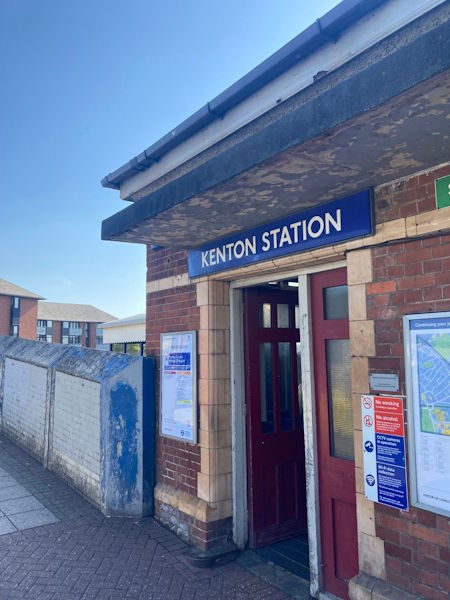
Photo: Dave W
Kenton station
| Postcode | HA3 0XS |
|---|
Transport
| Travel zone | 4 |
|---|---|
| Tube/Rail lines | |
| Next stations | |
| Nearby stations | |
| Bus stops |
Kenton Station (W)
Carlton Avenue Kenton (NE)
Upton Gardens (SW)
Northwick Park Station (W)
Northwick Park Station (W)
Odeon Parade Upton Gardens (E)
|
| Station code (TLC) | KNT |
| Station code (NLC) | 1399 |
| Owner | London Underground |
| National Rail Enquiries | |
Live Departures
Live Arrivals
Usage
Entries and exits
Interchanges
| Year | Entries and exits | Annual change % | Interchanges | Annual change % |
|---|---|---|---|---|
| 2025 | 1,438,022 | 24.2 % | ||
| 2024 | 1,158,158 | 7.5 % | ||
| 2023 | 1,076,884 | 14.7 % | ||
| 2022 | 938,670 | 82.5 % | ||
| 2021 | 514,426 | -54.4 % | ||
| 2020 | 1,128,902 | 6.2 % | ||
| 2019 | 1,063,332 | -2.3 % | ||
| 2018 | 1,088,734 | -4.4 % | ||
| 2017 | 1,138,724 | -8.1 % | ||
| 2016 | 1,239,124 | 11.3 % | ||
| 2015 | 1,113,232 | 4.4 % | ||
| 2014 | 1,065,998 | 5.3 % | ||
| 2013 | 1,011,972 | 2.1 % | ||
| 2012 | 991,410 | 20.9 % | ||
| 2011 | 820,316 | 98.6 % | ||
| 2010 | 413,026 | 55.1 % | ||
| 2009 | 266,358 | -10.1 % | ||
| 2008 | 296,394 | -1.5 % | ||
| 2007 | 300,890 | -6.3 % | ||
| 2006 | 321,286 | 0.9 % | ||
| 2005 | 318,304 |
Note: Data is for financial years, so 2020 is April 2019 to March 2020
Geography
| Latitude | 51.5818 | |
|---|---|---|
| Longitude | -0.316981 | |
| Easting | 516833 | |
| Northing | 188304 | |
| Grid reference | TQ168883 | |
| UTM reference | 30U 685886 5717937 | |
| what3words | ||
| Plus code | ||
| Distance away |
Postcodes
This map shows the postcodes where this station is the nearest to the postcode (as the crow flies)