Map of Kingston station, London
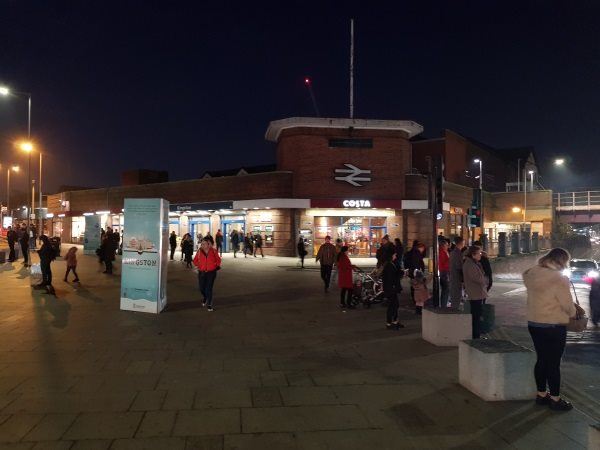
Kingston station
| Postcode | KT1 1UJ |
|---|
Transport
| Travel zone | 6 |
|---|---|
| Tube/Rail lines | |
| Next stations | |
| Nearby stations | |
| Bus stops |
Kingston (N)
Kingsgate Road (NE)
Kingston (W)
Cromwell Road Bus Station (N)
Cromwell Road Bus Station (N)
Kingston (W)
|
| Station code (TLC) | KNG |
| Station code (NLC) | 5565 |
| Owner | South Western Railway |
| National Rail Enquiries | |
Live Departures
Live Arrivals
Usage
Entries and exits
Interchanges
| Year | Entries and exits | Annual change % | Interchanges | Annual change % |
|---|---|---|---|---|
| 2025 | 4,360,664 | 5.2 % | ||
| 2024 | 4,143,270 | 13.7 % | ||
| 2023 | 3,643,910 | 19.3 % | ||
| 2022 | 3,053,908 | 165.5 % | ||
| 2021 | 1,150,134 | -75.3 % | ||
| 2020 | 4,650,286 | -7.2 % | ||
| 2019 | 5,012,744 | 2.7 % | ||
| 2018 | 4,879,574 | -10.3 % | ||
| 2017 | 5,440,164 | -3.1 % | ||
| 2016 | 5,615,666 | -9.2 % | ||
| 2015 | 6,186,850 | 3.3 % | ||
| 2014 | 5,986,660 | 2.1 % | ||
| 2013 | 5,865,428 | 4.4 % | ||
| 2012 | 5,618,414 | 6.5 % | ||
| 2011 | 5,276,390 | 5.3 % | ||
| 2010 | 5,008,774 | -2.9 % | ||
| 2009 | 5,160,632 | -10.9 % | ||
| 2008 | 5,790,757 | 3.5 % | ||
| 2007 | 5,596,609 | 73.4 % | ||
| 2006 | 3,226,866 | 2.0 % | ||
| 2005 | 3,163,324 |
Note: Data is for financial years, so 2020 is April 2019 to March 2020
Geography
| Latitude | 51.41275 | |
|---|---|---|
| Longitude | -0.301166 | |
| Easting | 518244 | |
| Northing | 169549 | |
| Grid reference | TQ182695 | |
| UTM reference | 30U 687675 5699182 | |
| what3words | ||
| Plus code | ||
| Distance away |
Postcodes
This map shows the postcodes where this station is the nearest to the postcode (as the crow flies)