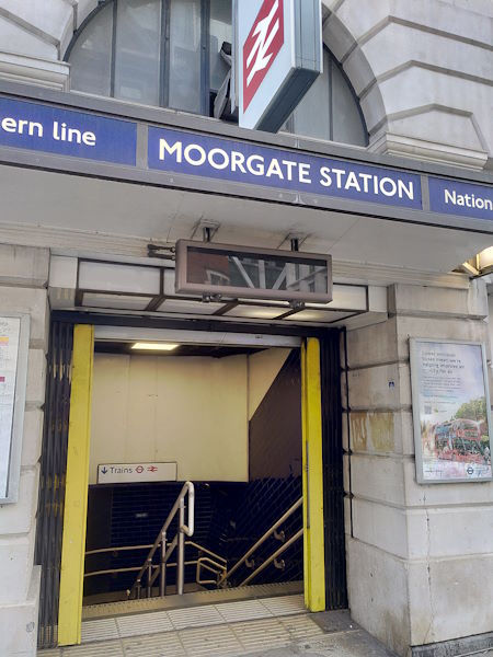
Map of Moorgate station, London

Moorgate station
| Postcode | EC2M 6TX |
|---|
Transport
| Travel zone | 1 |
|---|---|
| Tube/Rail lines | |
| Next stations | |
| Nearby stations | |
| Bus stops |
London Wall Moorgate Station (E)
Moorgate Station (W)
Finsbury Square (N)
Finsbury Street (W)
Finsbury Street (E)
Finsbury Square Moorgate (S)
|
| Station code (TLC) | MOG |
| Station code (NLC) | 6005 |
| Owner | London Underground |
| National Rail Enquiries | |
Live Departures
Live Arrivals
Usage
Entries and exits
Interchanges
| Year | Entries and exits | Annual change % | Interchanges | Annual change % |
|---|---|---|---|---|
| 2025 | 8,791,382 | 6.8 % | 380,285 | -29.2 % |
| 2024 | 8,228,538 | 47.3 % | 537,434 | -20.1 % |
| 2023 | 5,587,716 | 67.0 % | 672,934 | 56.7 % |
| 2022 | 3,346,156 | 72.9 % | 429,573 | 84.9 % |
| 2021 | 1,934,826 | -80.6 % | 232,270 | -65.6 % |
| 2020 | 9,993,570 | -13.2 % | 674,692 | -8.0 % |
| 2019 | 11,508,936 | 10.3 % | 733,167 | -18.8 % |
| 2018 | 10,433,502 | -3.7 % | 902,713 | 16.0 % |
| 2017 | 10,833,978 | 22.4 % | 778,077 | 76.7 % |
| 2016 | 8,849,564 | -5.8 % | 440,418 | -24.1 % |
| 2015 | 9,397,890 | 3.8 % | 580,450 | -11.7 % |
| 2014 | 9,051,956 | 13.2 % | 657,633 | 17.9 % |
| 2013 | 7,997,460 | 1.7 % | 557,579 | -13.0 % |
| 2012 | 7,860,382 | 9.4 % | 640,719 | 125.6 % |
| 2011 | 7,187,012 | 6.7 % | 284,028 | -78.0 % |
| 2010 | 6,736,698 | -28.1 % | 1,293,545 | 5.3 % |
| 2009 | 9,373,435 | -7.3 % | 1,228,701 | -9.0 % |
| 2008 | 10,108,616 | 9.4 % | 1,350,497 | 577.2 % |
| 2007 | 9,235,925 | 27.2 % | 199,438 | -79.5 % |
| 2006 | 7,263,068 | 1.8 % | 974,488 | 532.3 % |
| 2005 | 7,135,238 | 154,117 |
Note: Data is for financial years, so 2020 is April 2019 to March 2020
Geography
| Latitude | 51.51849 | |
|---|---|---|
| Longitude | -0.088943 | |
| Easting | 532688 | |
| Northing | 181677 | |
| Grid reference | TQ326816 | |
| UTM reference | 30U 701963 5711503 | |
| what3words | ||
| Plus code | ||
| Distance away |
Postcodes
This map shows the postcodes where this station is the nearest to the postcode (as the crow flies)