Map of North Dulwich station, London
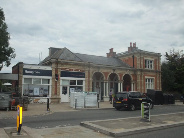
Photo: Adam SB
North Dulwich station
| Postcode | SE21 7BX |
|---|
Transport
| Travel zone | 2,3 |
|---|---|
| Tube/Rail lines | |
| Next stations | |
| Nearby stations | |
| Bus stops |
North Dulwich (NW)
Dulwich Village (SE21) (W)
Elmwood Road Charter School (SE)
Dulwich Village School (S)
Elmwood Road Charter School (NW)
Dulwich Village School (N)
|
| Station code (TLC) | NDL |
| Station code (NLC) | 5429 |
| Owner | Govia Thameslink Railway (Southern) |
| National Rail Enquiries | |
Live Departures
Live Arrivals
Usage
Entries and exits
Interchanges
| Year | Entries and exits | Annual change % | Interchanges | Annual change % |
|---|---|---|---|---|
| 2025 | 730,666 | 10.9 % | ||
| 2024 | 658,686 | 9.4 % | ||
| 2023 | 602,116 | 14.1 % | ||
| 2022 | 527,566 | 122.8 % | ||
| 2021 | 236,754 | -71.4 % | ||
| 2020 | 828,436 | 1.7 % | ||
| 2019 | 814,444 | 19.7 % | ||
| 2018 | 680,534 | 9.2 % | ||
| 2017 | 622,984 | -22.0 % | ||
| 2016 | 799,086 | -3.8 % | ||
| 2015 | 830,808 | -4.4 % | ||
| 2014 | 869,276 | 3.6 % | ||
| 2013 | 839,378 | -1.4 % | ||
| 2012 | 851,294 | 2.2 % | ||
| 2011 | 832,814 | 4.3 % | ||
| 2010 | 798,856 | 2.2 % | ||
| 2009 | 781,498 | 5.1 % | ||
| 2008 | 743,893 | -4.3 % | ||
| 2007 | 777,135 | 61.9 % | ||
| 2006 | 479,909 | -0.4 % | ||
| 2005 | 481,719 |
Note: Data is for financial years, so 2020 is April 2019 to March 2020
Geography
| Latitude | 51.454509 | |
|---|---|---|
| Longitude | -0.087918 | |
| Easting | 532950 | |
| Northing | 174567 | |
| Grid reference | TQ329745 | |
| UTM reference | 30U 702317 5704392 | |
| what3words | ||
| Plus code | ||
| Distance away |
Postcodes
This map shows the postcodes where this station is the nearest to the postcode (as the crow flies)