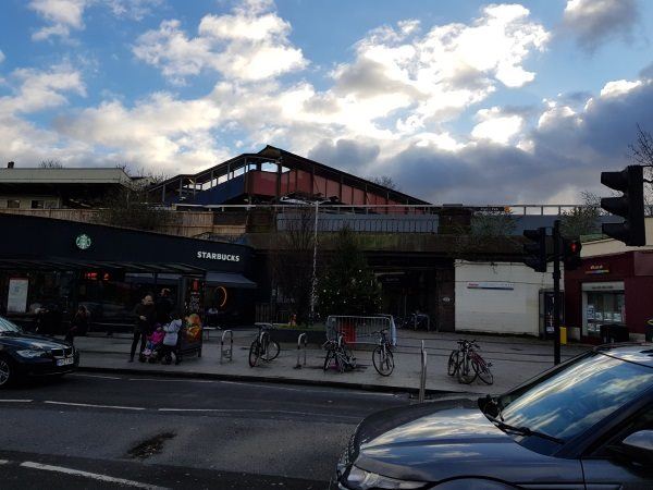
Map of Raynes Park station, London

Raynes Park station
| Postcode | SW20 8NE |
|---|
Transport
| Travel zone | 4 |
|---|---|
| Tube/Rail lines | |
| Next stations | |
| Nearby stations | |
| Bus stops |
Raynes Park (W)
Raynes Park (E)
Lambton Road (N)
Raynes Park (W)
Raynes Park Methodist Church (NE)
Bushey Road Grand Drive (E)
|
| Station code (TLC) | RAY |
| Station code (NLC) | 5569 |
| Owner | South Western Railway |
| National Rail Enquiries | |
Live Departures
Live Arrivals
Usage
Entries and exits
Interchanges
| Year | Entries and exits | Annual change % | Interchanges | Annual change % |
|---|---|---|---|---|
| 2025 | 3,497,682 | 6.4 % | 97,448 | 4.1 % |
| 2024 | 3,287,162 | 11.8 % | 93,595 | 28.7 % |
| 2023 | 2,939,854 | 21.4 % | 72,722 | -19.3 % |
| 2022 | 2,421,048 | 130.8 % | 90,070 | 161.3 % |
| 2021 | 1,048,876 | -73.8 % | 34,467 | -75.2 % |
| 2020 | 4,002,422 | -5.5 % | 139,242 | -11.2 % |
| 2019 | 4,236,152 | 2.0 % | 156,826 | 7.5 % |
| 2018 | 4,153,474 | -6.3 % | 145,867 | -16.5 % |
| 2017 | 4,432,044 | -0.0 % | 174,617 | -7.5 % |
| 2016 | 4,433,316 | -1.8 % | 188,811 | -19.6 % |
| 2015 | 4,513,818 | 1.9 % | 234,957 | 1.9 % |
| 2014 | 4,431,642 | 1.4 % | 230,530 | -3.9 % |
| 2013 | 4,369,770 | 4.0 % | 239,932 | -14.0 % |
| 2012 | 4,199,986 | 4.8 % | 279,012 | 5.7 % |
| 2011 | 4,008,324 | 5.6 % | 264,020 | 2.6 % |
| 2010 | 3,796,858 | -1.6 % | 257,273 | -1.9 % |
| 2009 | 3,860,188 | -9.1 % | 262,344 | -9.8 % |
| 2008 | 4,244,406 | -1.9 % | 290,929 | -7.1 % |
| 2007 | 4,325,766 | 89.1 % | 313,331 | 135.7 % |
| 2006 | 2,287,130 | -3.1 % | 132,935 | 10.6 % |
| 2005 | 2,359,176 | 120,244 |
Note: Data is for financial years, so 2020 is April 2019 to March 2020
Geography
| Latitude | 51.409172 | |
|---|---|---|
| Longitude | -0.230151 | |
| Easting | 523206 | |
| Northing | 169303 | |
| Grid reference | TQ232693 | |
| UTM reference | 30U 692628 5698968 | |
| what3words | ||
| Plus code | ||
| Distance away |
Postcodes
This map shows the postcodes where this station is the nearest to the postcode (as the crow flies)