Map of Rugby station
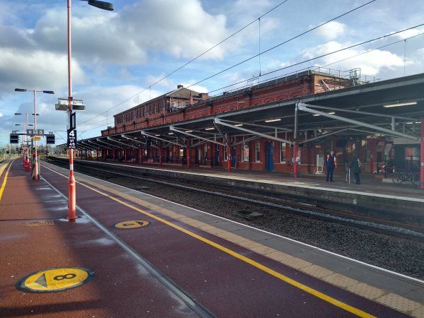
Rugby station
| Postcode | CV21 3LA |
|---|
Transport
| Nearby stations | |
|---|---|
| Bus stops |
Rugby Rail Station ()
Railway Station (E)
Abbey Street (S)
Abbey Street (N)
Carillion Rail Depot (NE)
Carillion Rail Depot (SW)
|
| Station code (TLC) | RUG |
| Station code (NLC) | 1087 |
| Owner | Avanti West Coast |
| National Rail Enquiries | |
Live Departures
Live Arrivals
Usage
Entries and exits
Interchanges
| Year | Entries and exits | Annual change % | Interchanges | Annual change % |
|---|---|---|---|---|
| 2025 | 2,392,296 | 10.7 % | 170,035 | -2.9 % |
| 2024 | 2,160,248 | 12.9 % | 175,154 | -3.1 % |
| 2023 | 1,913,342 | 12.8 % | 180,763 | 185.7 % |
| 2022 | 1,696,154 | 205.2 % | 63,266 | 240.4 % |
| 2021 | 555,702 | -79.3 % | 18,586 | -82.5 % |
| 2020 | 2,679,580 | -0.6 % | 106,057 | -17.4 % |
| 2019 | 2,695,802 | 6.6 % | 128,457 | 18.3 % |
| 2018 | 2,527,944 | 3.3 % | 108,544 | 4.5 % |
| 2017 | 2,447,026 | 7.3 % | 103,885 | 11.7 % |
| 2016 | 2,281,588 | 11.5 % | 93,031 | 7.6 % |
| 2015 | 2,046,704 | 6.2 % | 86,488 | 8.4 % |
| 2014 | 1,926,866 | 5.7 % | 79,789 | -54.2 % |
| 2013 | 1,823,162 | 4.1 % | 174,280 | 2.8 % |
| 2012 | 1,750,748 | 11.9 % | 169,587 | 46.4 % |
| 2011 | 1,564,834 | 13.1 % | 115,852 | 12.2 % |
| 2010 | 1,382,974 | 10.7 % | 103,274 | 0.2 % |
| 2009 | 1,248,816 | 7.6 % | 103,019 | 94.7 % |
| 2008 | 1,160,481 | 0.5 % | 52,904 | -73.0 % |
| 2007 | 1,154,728 | 5.4 % | 195,733 | 14.0 % |
| 2006 | 1,095,912 | 12.8 % | 171,698 | 219.3 % |
| 2005 | 971,631 | 53,777 |
Note: Data is for financial years, so 2020 is April 2019 to March 2020
Geography
| Latitude | 52.379095 | |
|---|---|---|
| Longitude | -1.250485 | |
| Easting | 451117 | |
| Northing | 275937 | |
| Grid reference | SP511759 | |
| UTM reference | 30U 619083 5804643 | |
| what3words | ||
| Plus code | ||
| Distance away |
Postcodes
This map shows the postcodes where this station is the nearest to the postcode (as the crow flies)