Map of Sunbury station
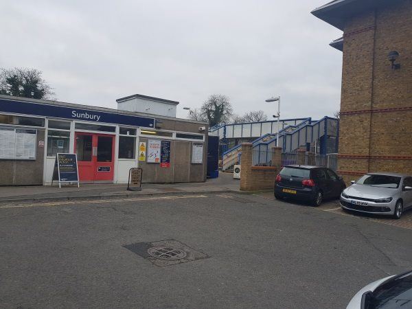
Sunbury station
| Postcode | TW16 6RZ |
|---|
Transport
| Nearby stations | |
|---|---|
| Bus stops |
St Ignatius Church (S)
Sunbury Cross (S)
Hanworth Road (SW)
St Ignatius Church (N)
Sunbury Cross (N)
Sunbury Cross Shopping Centre (E)
|
| Station code (TLC) | SUU |
| Station code (NLC) | 5608 |
| Owner | South Western Railway |
| National Rail Enquiries | |
Live Departures
Live Arrivals
Usage
Entries and exits
Interchanges
| Year | Entries and exits | Annual change % | Interchanges | Annual change % |
|---|---|---|---|---|
| 2025 | 390,536 | 8.1 % | ||
| 2024 | 361,398 | 21.3 % | ||
| 2023 | 298,000 | 41.6 % | ||
| 2022 | 210,398 | 220.3 % | ||
| 2021 | 65,682 | -82.8 % | ||
| 2020 | 381,432 | -6.9 % | ||
| 2019 | 409,878 | -3.2 % | ||
| 2018 | 423,614 | -2.6 % | ||
| 2017 | 434,878 | 0.5 % | ||
| 2016 | 432,748 | -0.9 % | ||
| 2015 | 436,480 | 5.5 % | ||
| 2014 | 413,598 | 2.2 % | ||
| 2013 | 404,602 | -0.4 % | ||
| 2012 | 406,054 | 1.6 % | ||
| 2011 | 399,816 | 1.7 % | ||
| 2010 | 392,978 | -8.8 % | ||
| 2009 | 431,054 | -6.0 % | ||
| 2008 | 458,341 | 27.0 % | ||
| 2007 | 360,997 | 1.4 % | ||
| 2006 | 355,893 | -0.1 % | ||
| 2005 | 356,232 |
Note: Data is for financial years, so 2020 is April 2019 to March 2020
Geography
| Latitude | 51.418312 | |
|---|---|---|
| Longitude | -0.417783 | |
| Easting | 510119 | |
| Northing | 169998 | |
| Grid reference | TQ101699 | |
| UTM reference | 30U 679545 5699508 | |
| what3words | ||
| Plus code | ||
| Distance away |
Postcodes
This map shows the postcodes where this station is the nearest to the postcode (as the crow flies)