Map of Sunningdale station
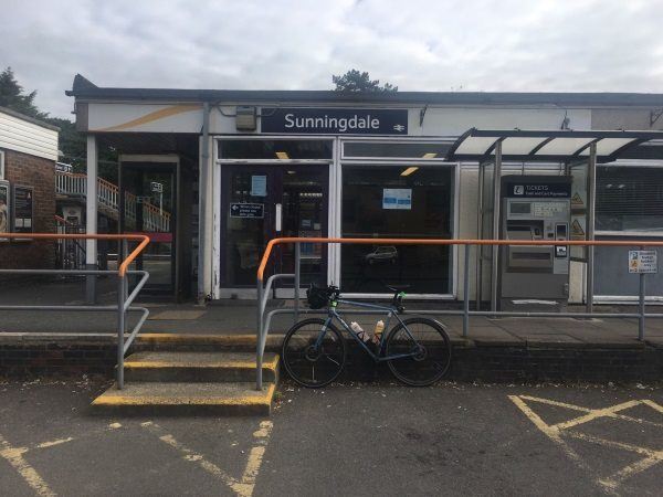
Photo: Martin W
Sunningdale station
| Postcode | SL5 0EL |
|---|
Transport
| Nearby stations | |
|---|---|
| Bus stops |
Sunningdale Railway Station (NE)
Sunningdale Railway Station (SW)
Charters Road (NW)
Broomhall Lane (S)
Broomhall Lane Recreation Ground (SE)
Broomhall Lane Recreation Ground (NW)
|
| Station code (TLC) | SNG |
| Station code (NLC) | 5671 |
| Owner | South Western Railway |
| National Rail Enquiries | |
Live Departures
Live Arrivals
Usage
Entries and exits
Interchanges
| Year | Entries and exits | Annual change % | Interchanges | Annual change % |
|---|---|---|---|---|
| 2025 | 597,214 | 16.7 % | ||
| 2024 | 511,574 | 10.9 % | ||
| 2023 | 461,418 | 26.9 % | ||
| 2022 | 363,724 | 211.0 % | ||
| 2021 | 116,946 | -81.1 % | ||
| 2020 | 617,980 | -6.4 % | ||
| 2019 | 660,020 | 1.4 % | ||
| 2018 | 650,626 | -5.2 % | ||
| 2017 | 686,640 | -1.5 % | ||
| 2016 | 697,446 | -0.0 % | ||
| 2015 | 697,686 | 1.5 % | ||
| 2014 | 687,424 | 0.1 % | ||
| 2013 | 686,458 | 0.4 % | ||
| 2012 | 683,954 | -1.6 % | ||
| 2011 | 694,750 | 5.4 % | ||
| 2010 | 659,460 | -10.2 % | ||
| 2009 | 734,290 | 5.2 % | ||
| 2008 | 697,761 | 12.3 % | ||
| 2007 | 621,218 | 9.1 % | ||
| 2006 | 569,347 | 4.2 % | ||
| 2005 | 546,425 |
Note: Data is for financial years, so 2020 is April 2019 to March 2020
Geography
| Latitude | 51.39194 | |
|---|---|---|
| Longitude | -0.633041 | |
| Easting | 495206 | |
| Northing | 166764 | |
| Grid reference | SU952667 | |
| UTM reference | 30U 664675 5696070 | |
| what3words | ||
| Plus code | ||
| Distance away |
Postcodes
This map shows the postcodes where this station is the nearest to the postcode (as the crow flies)