Map of Tattenham Corner station, London

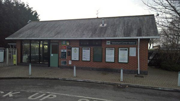
Tattenham Corner station
| Postcode | KT18 5PR |
|---|
Transport
| Travel zone | 6 |
|---|---|
| Tube/Rail lines | |
| Next stations | |
| Nearby stations | |
| Bus stops |
Tattenham Corner Railway Station (W)
Tattenham Corner (SE)
Tattenham Crescent (SE)
Tattenham Corner (NW)
Old London Road Car Park (E)
Tulyar Close (S)
|
| Station code (TLC) | TAT |
| Station code (NLC) | 5387 |
| Owner | Govia Thameslink Railway (Southern) |
| National Rail Enquiries | |
Live Departures
Live Arrivals
Usage
Entries and exits
Interchanges
| Year | Entries and exits | Annual change % | Interchanges | Annual change % |
|---|---|---|---|---|
| 2024 | 126,216 | -6.8 % | ||
| 2023 | 135,442 | 51.0 % | ||
| 2022 | 89,690 | 113.7 % | ||
| 2021 | 41,976 | -83.4 % | ||
| 2020 | 252,252 | 2.2 % | ||
| 2019 | 246,770 | 6.1 % | ||
| 2018 | 232,642 | 1.7 % | ||
| 2017 | 228,812 | -19.3 % | ||
| 2016 | 283,452 | -3.2 % | ||
| 2015 | 292,692 | -4.8 % | ||
| 2014 | 307,592 | 5.0 % | ||
| 2013 | 292,810 | 5.1 % | ||
| 2012 | 278,686 | 14.0 % | ||
| 2011 | 244,492 | 2.1 % | ||
| 2010 | 239,366 | -3.4 % | ||
| 2009 | 247,666 | 7.9 % | ||
| 2008 | 229,638 | 8.6 % | ||
| 2007 | 211,533 | 10.9 % | ||
| 2006 | 190,712 | 10.0 % | ||
| 2005 | 173,374 |
Note: Data is for financial years, so 2020 is April 2019 to March 2020
Geography
| Latitude | 51.309182 | |
|---|---|---|
| Longitude | -0.242609 | |
| Easting | 522593 | |
| Northing | 158140 | |
| Grid reference | TQ225581 | |
| UTM reference | 30U 692180 5687818 | |
| what3words | ||
| Plus code | ||
| Distance away |
Postcodes
This map shows the postcodes where this station is the nearest to the postcode (as the crow flies)