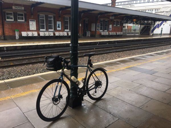
Map of Twyford station, London

Photo: Martin W
Twyford station
| Postcode | RG10 9NA |
|---|
Transport
| Travel zone | Outside zone 6 |
|---|---|
| Tube/Rail lines | |
| Next stations | |
| Nearby stations | |
| Bus stops |
Twyford Station (W)
Church Street (SE)
Waitrose (W)
Waitrose (E)
Springfield Park (SW)
Winchcombe Road Foot (E)
|
| Station code (TLC) | TWY |
| Station code (NLC) | 3155 |
| Owner | Great Western Railway |
| National Rail Enquiries | |
Live Departures
Live Arrivals
Usage
Entries and exits
Interchanges
| Year | Entries and exits | Annual change % | Interchanges | Annual change % |
|---|---|---|---|---|
| 2025 | 1,754,790 | 12.2 % | 772,325 | 15.5 % |
| 2024 | 1,563,894 | 44.6 % | 668,774 | 20.5 % |
| 2023 | 1,081,660 | 35.0 % | 555,106 | 45.2 % |
| 2022 | 801,214 | 200.9 % | 382,341 | 186.9 % |
| 2021 | 266,248 | -82.6 % | 133,246 | -82.4 % |
| 2020 | 1,527,952 | 1.3 % | 756,820 | -4.3 % |
| 2019 | 1,508,004 | 6.8 % | 791,039 | 0.7 % |
| 2018 | 1,411,386 | 2.0 % | 785,773 | 17.7 % |
| 2017 | 1,383,438 | 0.3 % | 667,443 | 2.5 % |
| 2016 | 1,379,522 | 0.8 % | 650,877 | 2.0 % |
| 2015 | 1,369,126 | 0.5 % | 638,123 | 0.1 % |
| 2014 | 1,361,892 | 1.1 % | 637,571 | 4.3 % |
| 2013 | 1,347,178 | 3.7 % | 611,011 | 4.3 % |
| 2012 | 1,299,418 | 5.4 % | 585,625 | 100.1 % |
| 2011 | 1,232,710 | 2.2 % | 292,666 | 9.0 % |
| 2010 | 1,206,166 | -3.0 % | 268,610 | -8.3 % |
| 2009 | 1,242,858 | 1.7 % | 293,014 | -5.1 % |
| 2008 | 1,222,401 | 1.1 % | 308,684 | -26.7 % |
| 2007 | 1,208,757 | 7.2 % | 421,370 | 1.5 % |
| 2006 | 1,127,475 | 4.1 % | 414,987 | -2.7 % |
| 2005 | 1,083,059 | 426,370 |
Note: Data is for financial years, so 2020 is April 2019 to March 2020
Geography
| Latitude | 51.475534 | |
|---|---|---|
| Longitude | -0.863293 | |
| Easting | 479041 | |
| Northing | 175787 | |
| Grid reference | SU790757 | |
| UTM reference | 30U 648386 5704873 | |
| what3words | ||
| Plus code | ||
| Distance away |
Postcodes
This map shows the postcodes where this station is the nearest to the postcode (as the crow flies)