Map of West Ealing station, London
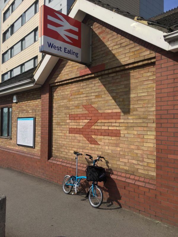
Photo: Martin W
West Ealing station
| Postcode | W13 0NQ |
|---|
Transport
| Travel zone | 3 |
|---|---|
| Tube/Rail lines | |
| Next stations | |
| Nearby stations | |
| Bus stops |
West Ealing Station (N)
Drayton Green Road (N)
The Avenue (W13) (W)
Drayton Green Road (S)
The Avenue (W13) (E)
Sutherland Avenue (W13) (S)
|
| Station code (TLC) | WEA |
| Station code (NLC) | 3188 |
| Owner | TfL Rail |
| National Rail Enquiries | |
Live Departures
Live Arrivals
Usage
Entries and exits
Interchanges
| Year | Entries and exits | Annual change % | Interchanges | Annual change % |
|---|---|---|---|---|
| 2024 | 2,256,266 | 78.9 % | 77,895 | 148.8 % |
| 2023 | 1,261,474 | 62.9 % | 31,302 | 8.9 % |
| 2022 | 774,424 | 127.6 % | 28,755 | 89.3 % |
| 2021 | 340,254 | -71.2 % | 15,194 | -78.1 % |
| 2020 | 1,182,062 | 9.7 % | 69,361 | 5.1 % |
| 2019 | 1,077,698 | 4.2 % | 65,972 | -21.9 % |
| 2018 | 1,034,660 | 12.0 % | 84,457 | 56.6 % |
| 2017 | 923,710 | -6.6 % | 53,930 | 2815.1 % |
| 2016 | 989,068 | -26.6 % | 1,850 | 27.1 % |
| 2015 | 1,347,024 | 3.4 % | 1,456 | 63.4 % |
| 2014 | 1,302,320 | 11.2 % | 891 | -29.3 % |
| 2013 | 1,170,790 | 5.5 % | 1,260 | 29.9 % |
| 2012 | 1,109,636 | 3.8 % | 970 | 69.6 % |
| 2011 | 1,069,164 | 40.7 % | 572 | 137.3 % |
| 2010 | 759,796 | -15.1 % | 241 | 244.3 % |
| 2009 | 895,372 | -29.2 % | 70 | -88.4 % |
| 2008 | 1,264,480 | 17.2 % | 603 | 141.2 % |
| 2007 | 1,078,954 | 190.7 % | 250 | 2.5 % |
| 2006 | 371,096 | -3.6 % | 244 | -17.8 % |
| 2005 | 384,890 | 297 |
Note: Data is for financial years, so 2020 is April 2019 to March 2020
Geography
| Latitude | 51.513504 | |
|---|---|---|
| Longitude | -0.320133 | |
| Easting | 516690 | |
| Northing | 180749 | |
| Grid reference | TQ166807 | |
| UTM reference | 30U 685946 5710336 | |
| what3words | ||
| Plus code | ||
| Distance away |
Postcodes
This map shows the postcodes where this station is the nearest to the postcode (as the crow flies)