Map of West Norwood station, London
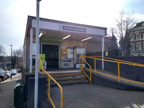
West Norwood station
| Postcode | SE27 0HS |
|---|
Transport
| Travel zone | 3 |
|---|---|
| Tube/Rail lines | |
| Next stations | |
| Nearby stations | |
| Bus stops |
West Norwood (S)
St Julian's Farm Road (N)
Robson Road Norwood Road (E)
Robson Road Norwood Road (W)
West Norwood Bus Garage (W)
Norwood Road Robson Road (S)
|
| Station code (TLC) | WNW |
| Station code (NLC) | 5438 |
| Owner | Govia Thameslink Railway (Southern) |
| National Rail Enquiries | |
Live Departures
Live Arrivals
Usage
Entries and exits
Interchanges
| Year | Entries and exits | Annual change % | Interchanges | Annual change % |
|---|---|---|---|---|
| 2024 | 1,406,230 | 27.7 % | 26,912 | 3.7 % |
| 2023 | 1,101,482 | 20.5 % | 25,947 | 48.1 % |
| 2022 | 914,348 | 76.9 % | 17,524 | 103.0 % |
| 2021 | 517,006 | -73.8 % | 8,631 | -70.6 % |
| 2020 | 1,972,420 | 1.8 % | 29,312 | 2.4 % |
| 2019 | 1,938,126 | 0.9 % | 28,623 | 19.3 % |
| 2018 | 1,921,358 | -0.8 % | 23,988 | 6.6 % |
| 2017 | 1,937,082 | -12.8 % | 22,493 | -25.7 % |
| 2016 | 2,221,492 | -1.9 % | 30,256 | 24.6 % |
| 2015 | 2,265,218 | 6.9 % | 24,277 | 4.6 % |
| 2014 | 2,118,260 | 2.1 % | 23,213 | -54.0 % |
| 2013 | 2,073,698 | -1.0 % | 50,468 | -45.0 % |
| 2012 | 2,094,348 | 7.9 % | 91,687 | 43.5 % |
| 2011 | 1,940,696 | 11.9 % | 63,889 | 64.3 % |
| 2010 | 1,734,910 | 1.7 % | 38,887 | -20.8 % |
| 2009 | 1,706,394 | -7.5 % | 49,097 | 116.1 % |
| 2008 | 1,845,177 | 29.8 % | 22,721 | 31.5 % |
| 2007 | 1,421,765 | 78.9 % | 17,272 | 39.7 % |
| 2006 | 794,560 | -3.8 % | 12,362 | 19.0 % |
| 2005 | 826,002 | 10,387 |
Note: Data is for financial years, so 2020 is April 2019 to March 2020
Geography
| Latitude | 51.431746 | |
|---|---|---|
| Longitude | -0.10383 | |
| Easting | 531956 | |
| Northing | 171955 | |
| Grid reference | TQ319719 | |
| UTM reference | 30U 701312 5701818 | |
| what3words | ||
| Plus code | ||
| Distance away |
Postcodes
This map shows the postcodes where this station is the nearest to the postcode (as the crow flies)