Map of Worcester Park station, London
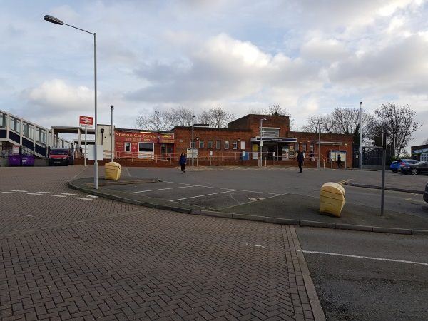
Worcester Park station
| Postcode | KT4 7ND |
|---|
Transport
| Travel zone | 4 |
|---|---|
| Tube/Rail lines | |
| Next stations | |
| Nearby stations | |
| Bus stops |
Worcester Park (SE)
Worcester Park (NW)
Green Lane Hazlemere Gardens (NE)
Green Lane Hazlemere Gardens (S)
Longfellow Road (KT4) (NW)
Longfellow Road (KT4) (SE)
|
| Station code (TLC) | WCP |
| Station code (NLC) | 5579 |
| Owner | South Western Railway |
| National Rail Enquiries | |
Live Departures
Live Arrivals
Usage
Entries and exits
Interchanges
| Year | Entries and exits | Annual change % | Interchanges | Annual change % |
|---|---|---|---|---|
| 2024 | 1,359,150 | 14.3 % | ||
| 2023 | 1,188,988 | 21.3 % | ||
| 2022 | 979,904 | 132.2 % | ||
| 2021 | 421,954 | -79.9 % | ||
| 2020 | 2,098,382 | -11.0 % | ||
| 2019 | 2,359,004 | 7.3 % | ||
| 2018 | 2,198,960 | -7.1 % | ||
| 2017 | 2,366,392 | -3.1 % | ||
| 2016 | 2,442,322 | -11.0 % | ||
| 2015 | 2,745,468 | -0.1 % | ||
| 2014 | 2,746,968 | 1.1 % | ||
| 2013 | 2,715,944 | 1.2 % | ||
| 2012 | 2,683,706 | 1.1 % | ||
| 2011 | 2,655,248 | 4.5 % | ||
| 2010 | 2,539,716 | -2.5 % | ||
| 2009 | 2,605,318 | -6.6 % | ||
| 2008 | 2,790,533 | 3.8 % | ||
| 2007 | 2,688,280 | 85.0 % | ||
| 2006 | 1,453,302 | -1.2 % | ||
| 2005 | 1,471,082 |
Note: Data is for financial years, so 2020 is April 2019 to March 2020
Geography
| Latitude | 51.381251 | |
|---|---|---|
| Longitude | -0.245167 | |
| Easting | 522192 | |
| Northing | 166133 | |
| Grid reference | TQ221661 | |
| UTM reference | 30U 691700 5695824 | |
| what3words | ||
| Plus code | ||
| Distance away |
Postcodes
This map shows the postcodes where this station is the nearest to the postcode (as the crow flies)