Map of Gipsy Hill station, London

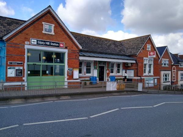
Gipsy Hill station
| Postcode | SE19 1PL |
|---|
Transport
| Travel zone | 3 |
|---|---|
| Tube/Rail lines | |
| Next stations | |
| Nearby stations | |
| Bus stops |
Gipsy Hill Station (S)
Dulwich Wood Avenue (S)
Highland Road (N)
Dulwich Wood Park Kingswood Drive (W)
Highland Road (S)
Gipsy Hill Gipsy Road (S)
|
| Station code (TLC) | GIP |
| Station code (NLC) | 5363 |
| Owner | Govia Thameslink Railway (Southern) |
| National Rail Enquiries | |
Live Departures
Live Arrivals
Usage
Entries and exits
Interchanges
| Year | Entries and exits | Annual change % | Interchanges | Annual change % |
|---|---|---|---|---|
| 2025 | 1,401,264 | 5.7 % | ||
| 2024 | 1,325,654 | 22.4 % | ||
| 2023 | 1,083,192 | 19.8 % | ||
| 2022 | 904,234 | 91.6 % | ||
| 2021 | 472,048 | -73.3 % | ||
| 2020 | 1,768,372 | 0.6 % | ||
| 2019 | 1,757,758 | 1.5 % | ||
| 2018 | 1,731,828 | 1.0 % | ||
| 2017 | 1,715,420 | -12.8 % | ||
| 2016 | 1,968,148 | -4.6 % | ||
| 2015 | 2,063,946 | 3.6 % | ||
| 2014 | 1,992,136 | 2.5 % | ||
| 2013 | 1,943,522 | 1.5 % | ||
| 2012 | 1,915,066 | 11.4 % | ||
| 2011 | 1,718,698 | 10.1 % | ||
| 2010 | 1,560,968 | -8.5 % | ||
| 2009 | 1,705,800 | -8.9 % | ||
| 2008 | 1,871,823 | 17.3 % | ||
| 2007 | 1,595,174 | 40.7 % | ||
| 2006 | 1,133,747 | 5.2 % | ||
| 2005 | 1,077,284 |
Note: Data is for financial years, so 2020 is April 2019 to March 2020
Geography
| Latitude | 51.424452 | |
|---|---|---|
| Longitude | -0.083836 | |
| Easting | 533321 | |
| Northing | 171237 | |
| Grid reference | TQ333712 | |
| UTM reference | 30U 702734 5701062 | |
| what3words | ||
| Plus code | ||
| Distance away |
Postcodes
This map shows the postcodes where this station is the nearest to the postcode (as the crow flies)